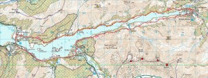
After running off-road every night this week bar one (Wednesday’s road run) and finding Thursday’s and Friday’s efforts severely snowy struggles, I decided I deserved a long, ‘easy’ run for some cheap mileage and headed out this afternoon to run round the Loch. Which took me 2 hours 49 mins for 20.2 miles of hilly road running (of which more shortly), bringing my total since Monday to 58 miles and really not being too bad for a glorified jog (with some renewed discomfort from the bash I took to my ribs on WML Training last week) the day after taking nearly two hours to cover six miles! And that should be pretty well all I need to report just now except for a most interesting discovery about the ascent and descent recorded by my Garmin Forerunner (in this case my new 310XT, but probably applying to my older 305 as well)…
Now, popular opinion seems to suggest that the Garmin altitude readings are way too high, although I’ve found them to be surprisingly consistent in practice with Memory-Map elevation profiles for the same routes on open hill ground. But today’s run comes out as 2,007 ft ascent/2,025 ft descent in Garmin Training Center, 2,381 ft of elevation gain in Garmin Connect (a discrepancy already noted in my brief 310XT review) and an even more impressive 2,688 ft when converting the track to a route in Memory-Map and letting it recalculate the ascent. So make of that what you will, but here at least it looks like the GPS could be under (rather than over) estimating the altitudes!


