Petestack Blog

31 December 2014

Plane over Moon over Dearg

Filed under: Walking — admin @ 11:36 am

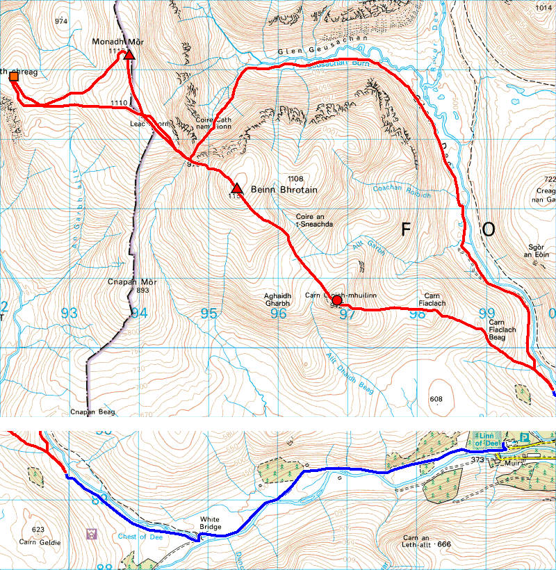
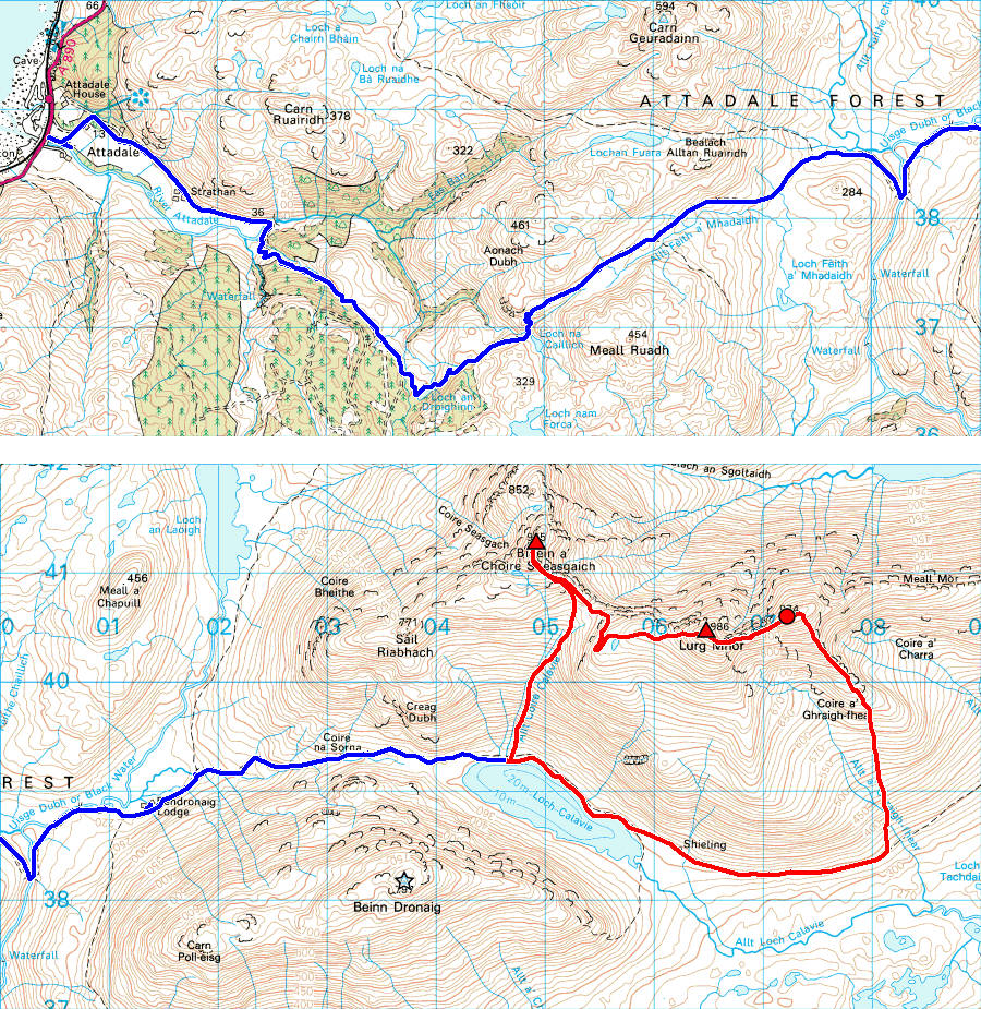
Suddenly, after a largely lousy December for coincident good hill conditions and free time, forecasts were pointing to three or four consecutive grab-me-while-you-can days and I was off to start cleaning up the North-West…

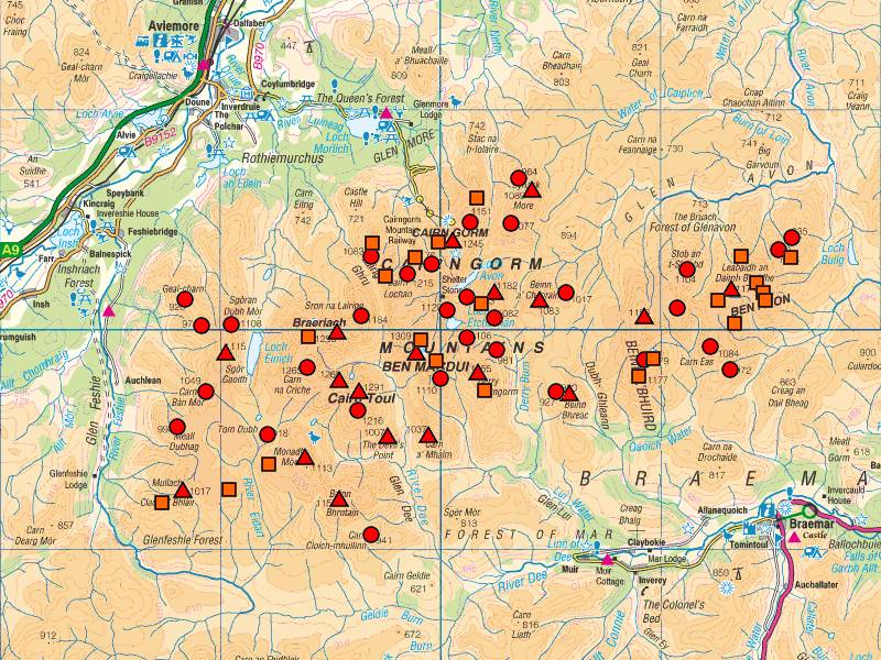
First stop Fionn Bheinn en route to Ullapool on Saturday, followed by my final Fannichs on Sunday, a return to the ‘Deargs’ on Monday for the deleted Top (!) missed in 2008 and a soggy Moruisg and Sgurr nan Ceannaichean on my way home on Tuesday. Which adds up to a whacking great chunk of what I need by May when, apart from two Munros, one Top and one Deletion elsewhere, what remains uncoloured on today’s map is all that’s left of my 601 all-time-listed ‘3,000ft’ tops.

2014-12-30map

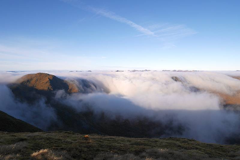
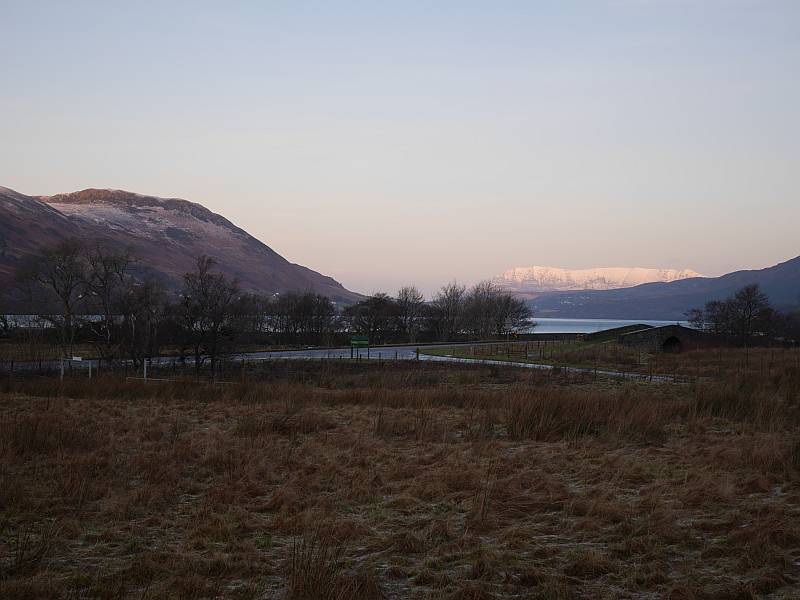
Not a huge amount to say about Fionn Bheinn here. It’s a modest wee singleton, perhaps famed more as a splendid viewpoint than for itself. Conditions were crisp, cold and windy, but I was really more concerned about the condition of the roads (and getting back up from my icy parking spot by Achnasheen Station) than the hill. And the cloud came and went, alternately obscuring and revealing both summit and more distant views, with only my ultimate target of Slioch truly playing hard to get and ducking the camera as a more consistently fleeting presence.

2014-12-27fionnbheinn1 2014-12-27fionnbheinn2

So on to Ullapool, where (really not fancying several days’ sub-zero camping or dossing in the van) I’d treated myself to the rare luxury of proper paid accommodation and booked at the Argyll Hotel. Which might have been extravagant, but made all the difference to a pleasant trip with a comfortable room and excellent food… on which note, money’s only of value for what it can do for you and, yes, I’d do it again!

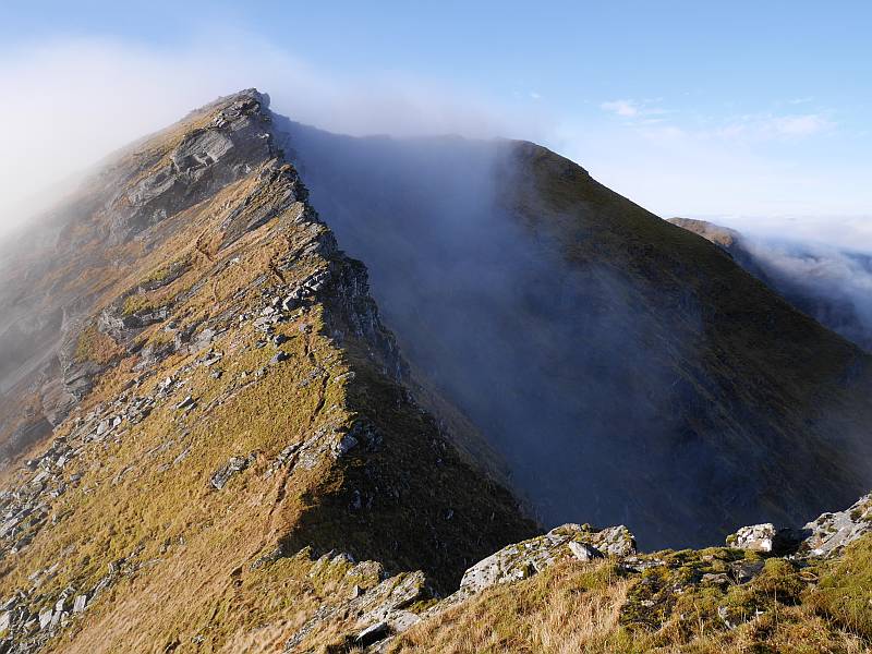
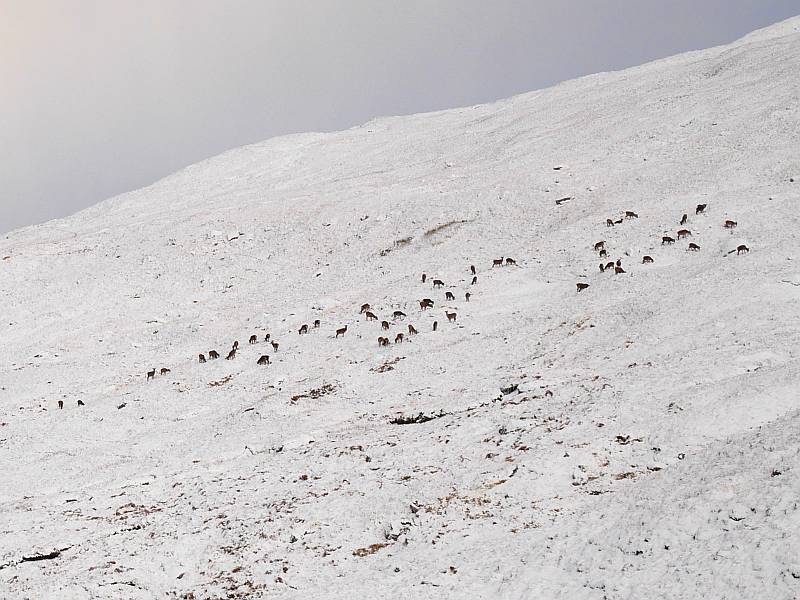
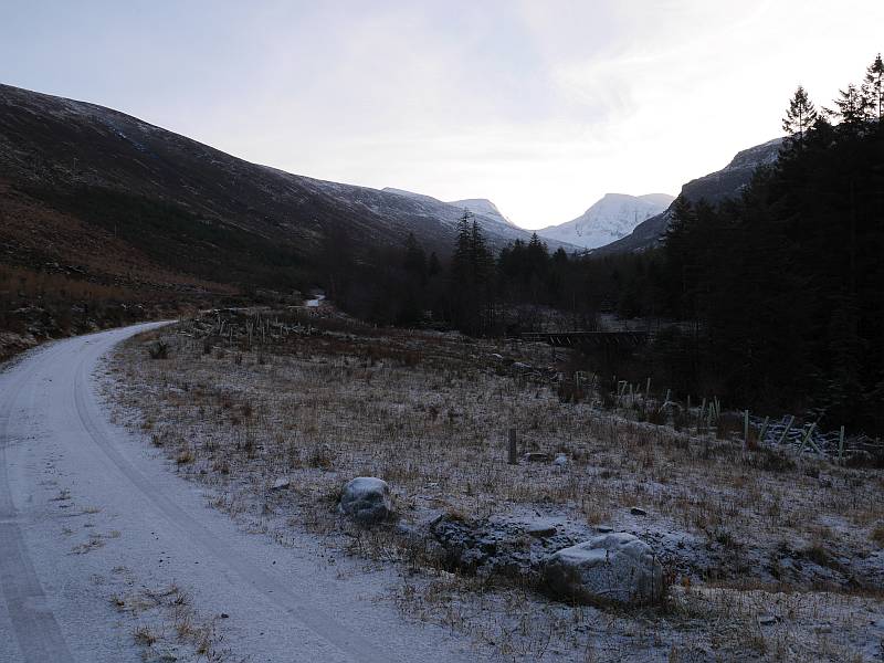
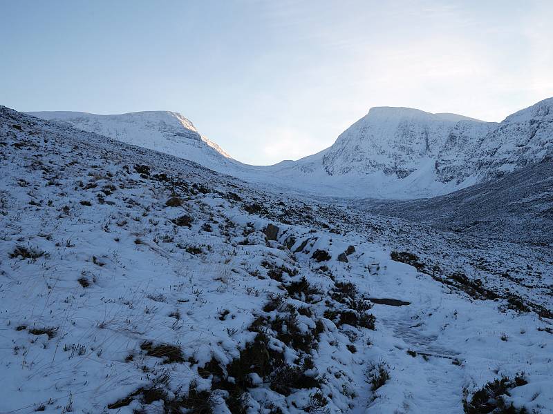
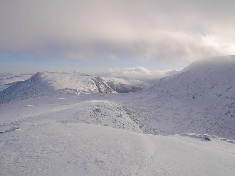
Having noted the bottom of the Gairloch road as still quite snowy in passing on Saturday, I was a little concerned about getting up past Braemore Junction to the start of the Loch A’ Bhraoin path but, while not surprisingly finding it still much the same on a cold, cold Sunday morning, needn’t have worried. And there were perhaps six or seven vehicles already parked up there, with just one truly viable space left for me. I chose to tackle my round of two Munros and a Top anticlockwise to deal with the most pathless ground first, landing on top of A’ Chailleach in a whiteout soupy enough to make locating the surprisingly indistinct start of the ridge to Toman Coinich quite awkward as (with compass in one hand and GPS in the other) I’d find myself ploughing through localised drifts on the flat shoulder that disconcertingly screamed ‘cornice’ but weren’t! But things were starting to clear by the next bealach, the couple I met heading up what I’d just come down probably had an easier time of it, and I enjoyed a nice walk down (interesting discussion about photography and winter tyres!) in and out of the cloud from Sgurr Breac with Mike Dunlop from Keith, who I met on the summit.

2014-12-28lochabhraoin 2014-12-28deer

2014-12-28sgurrbreac

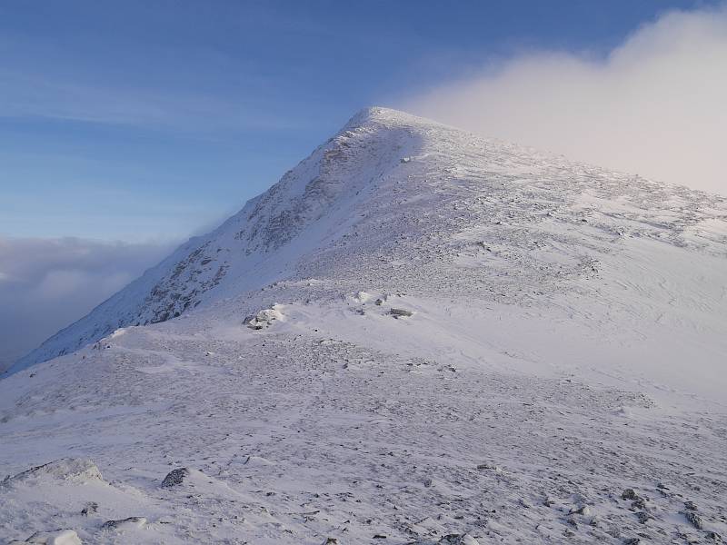
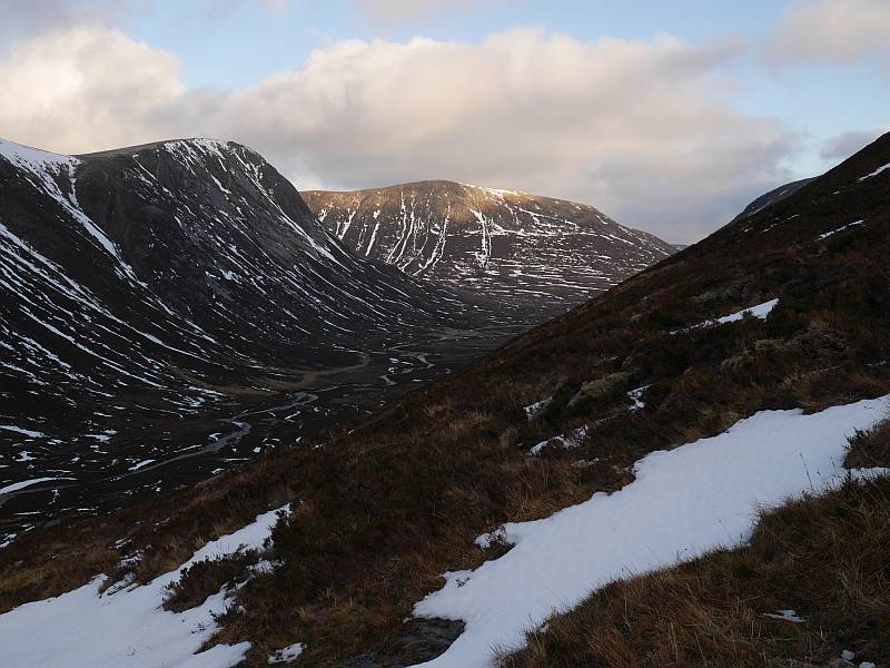
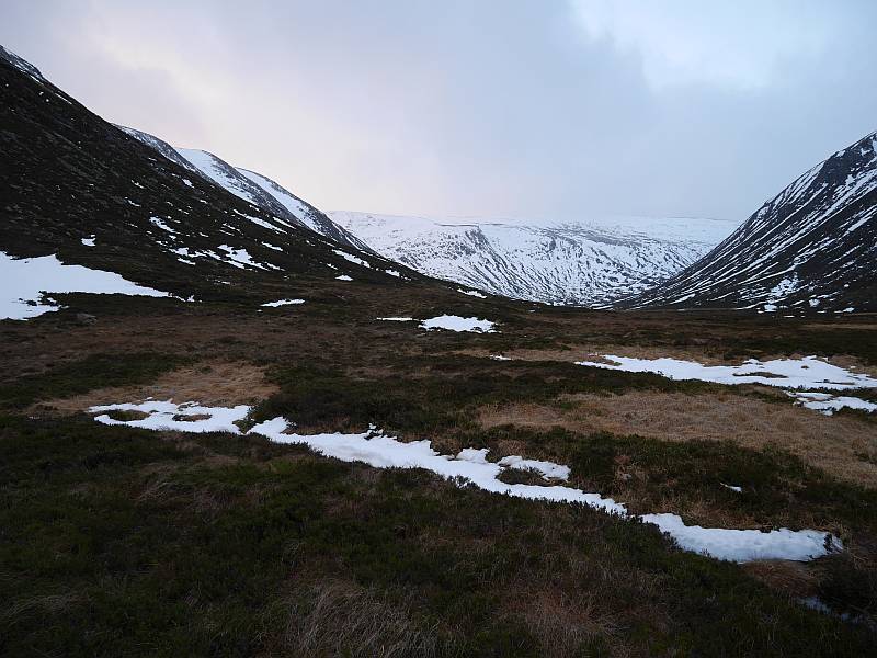
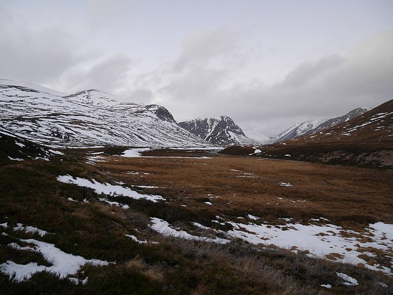
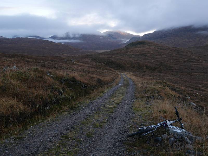
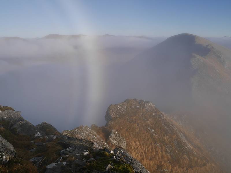
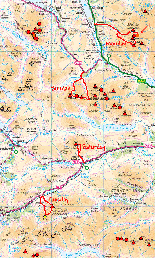
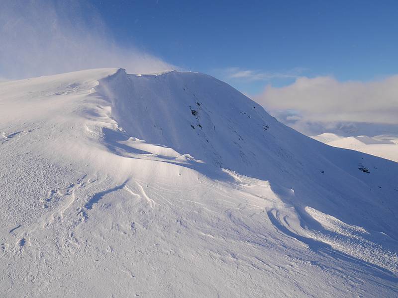
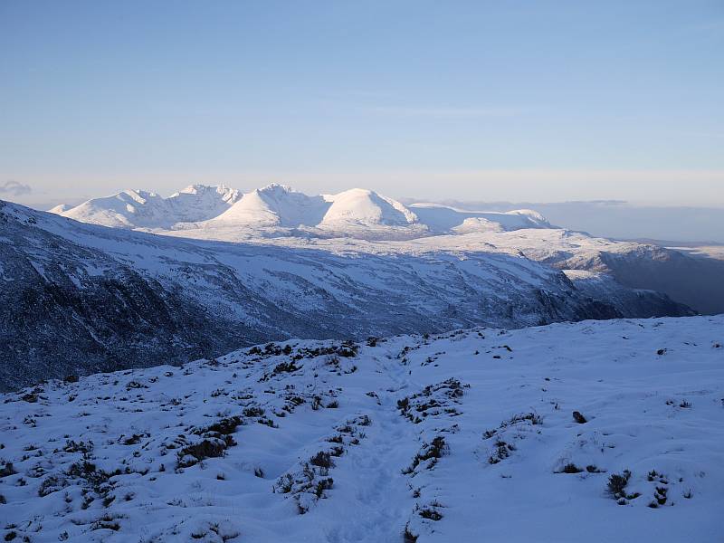
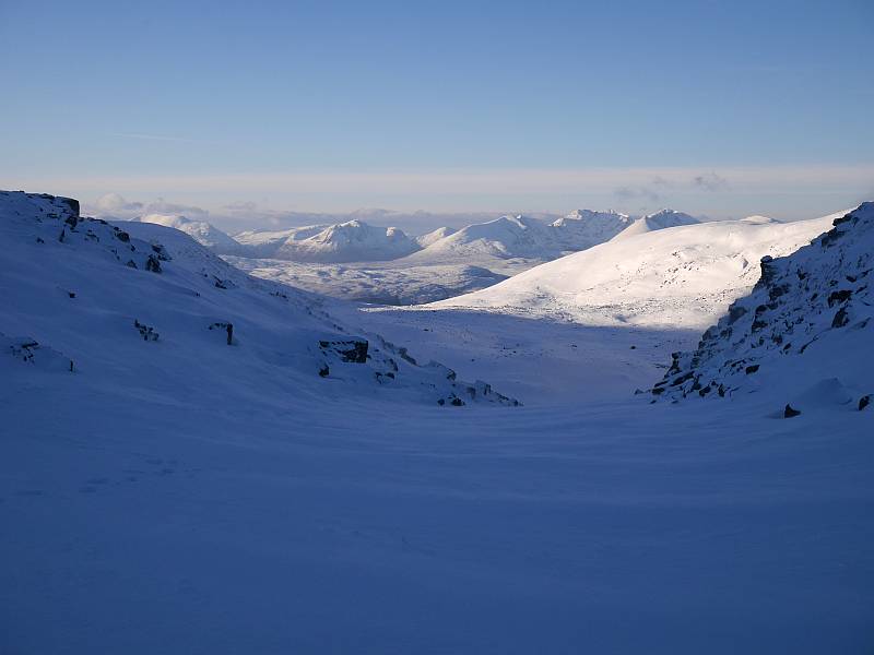
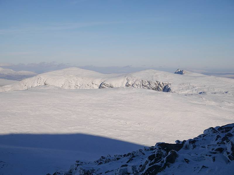
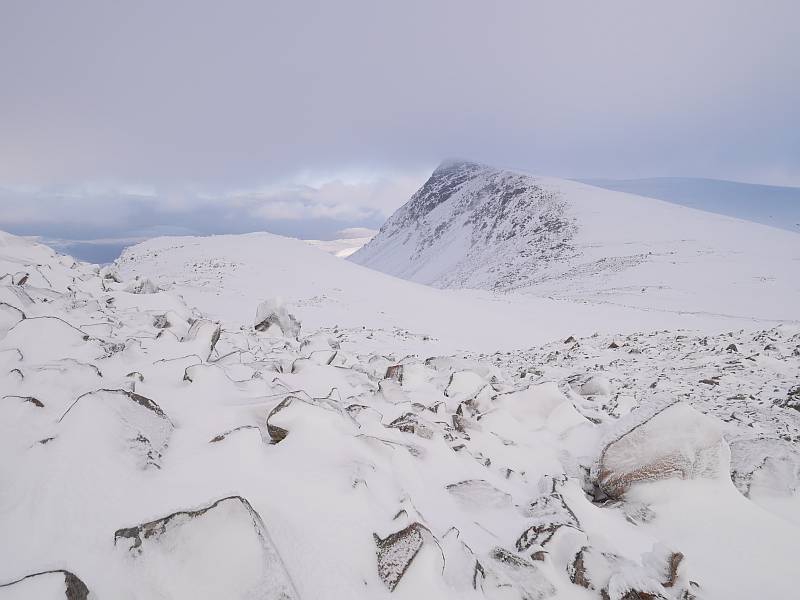
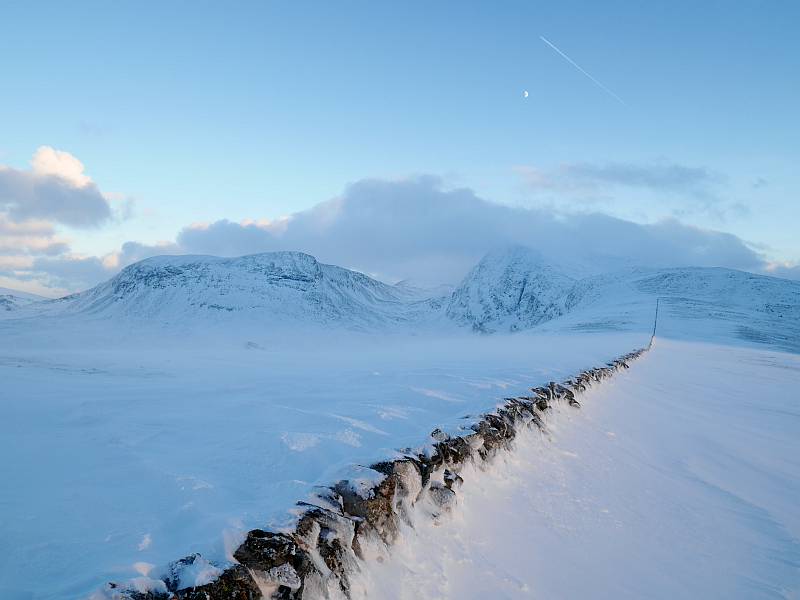
Now, the missed deleted Top of Ceann Garbh ‘old position’ had been bugging me ever since a memorable weekend in 2008 when I’d traversed the whole of An Teallach on the Friday afternoon/evening, the four ‘Deargs’ (missing the Deletion after failing to mark it on my map) and Seana Bhraigh on the Saturday and Beinn Alligin on the Sunday. But no Dearg day is wasted, a winter round of Meall nan Ceapraichean (with both versions of Ceann Garbh) and Beinn Dearg looked attractive, and I had the hills to myself after meeting a pair of climbers returning down Gleann na Squaib following their ascent of Penguin Gully and overnight camp. It was another crisp, cold morning, with the bicycle I’d brought with the glen in mind left in the van as I took the icy track on foot, but spectacular with it as turning round to catch sight of a snowy An Teallach brought an audible ‘wow!’ After which the clouds slowly started to roll in, with still-good views from Ceann Garbh and Meall nan Ceapraichean turning to the whitest of whiteouts on Dearg, where the massive summit cairn was still coming and going at about 10 metres distance. So another blind descent to pick up the famous wall (which was close to buried at points) and the summit never cleared again that day, but numerous chilly attempts to time a photograph with the Moon over Dearg unobscured by a sea of moving cloud were finally rewarded with the opportunistic bonus of ‘Plane over Moon over Dearg’… or perhaps symbolically just ‘over the moon’ with a possible eagle sighting too before finally dropping back to the glen to hit the main road in near dark at 5:00pm!

2014-12-29benmorcoigach 2014-12-29gleannnasquaib

2014-12-29ceapraicheananddearg 2014-12-29anteallach1

2014-12-29anteallach2 2014-12-29seanabhraigh

2014-12-29conamheallanddearg 2014-12-29ceapraichean

2014-12-29planeovermoonoverdearg

So I said something about the forecasts pointing to three or four consecutive good hill days, and that turned out to be three in the end with a big Monday-night thaw clearing the roads (good!) and largely stripping the hills of snow (more debatable?), but a still very useful, if soggy, Moruisg and Sgurr nan Ceannaichean picked up on the way home. Not that I saw either of them, although they were slowly clearing by mid-afternoon when I left, but I did find both cairns on both double-cairned peaks (where the higher in each case seems to be the smaller and less significant-looking one), which was more than the party of four who’d not unnaturally just assumed the larger of the two on Moruisg was the summit. So perhaps just a final warning to baggers… while neither the Moruisg nor Ceannaichean cairns quite match the famous false summit of Beinn Dorain in the ‘imposter’ league, you could still miss their barely-higher true tops in poor visibility if you didn’t know!

24 December 2014

Last of the Monadh Ruadh

Filed under: Cycling,Walking — admin @ 6:32 pm

This blog needs a ‘walking’ category. Can’t remember why I didn’t set one up in the first place (maybe I just thought I didn’t walk much?), but sometimes things get posted as ‘climbing’ or ‘running’ that are really more ‘walking’, so I just made a new category for them and hereby launch it with yesterday’s first ‘boots, axe and crampons’ (the last carried but not used) trip of the winter…

Now Beinn Bhrotain and Monadh Mor are two awkwardly-placed big hills (my final Monadh Ruadh/Cairngorms Munros) I was keen to get before any prolonged winter snows spoiled my chances of cycling in from Linn of Dee, and yesterday’s benevolent weather and SAIS forecasts were pretty well screaming ‘take the chance while you can’. So I was up at 4am and on my way within the hour to be leaving Linn of Dee at first light for a circuit which, being somewhat more ambitious than that described by Cameron McNeish as ‘a major undertaking’ in winter and ‘a long way for the short days of November’, was clearly just the ticket for 23 December ‘daylight’ with a good three hours of driving at either end!

2014-12-23map

Abandoning the bike at an almost random point on the single track above White Bridge where I was starting to carry it over more icy snow than riding it, I headed up over the former Munro of Carn Cloich-mhuilinn (sadly demoted to Top, although I’d agree it’s a ‘Top’, when Munro himself had been saving it for last) and still showery/cloudy Beinn Bhrotain to start opening up the most fabulously-lit views over Glen Geusachan to Bod an Deamhain and Ben Macdui as I descended to the bealach before Monadh Mor. But the chilly wind bit my fingers so hard as I dug out my camera for the first time that I simply had to replace my gloves, forget the photos, keep moving and hope I’d get the same chance on my way back. But I didn’t, so you’re not going to see them after more misty plodding over Monadh Mor and the deleted Top of Leth-chreag (where I had to cover two cairned and ring-contoured possibilities after neglecting to mark it on the map I took) led to a descent that looked attractive at the time but has to be slower than just repeating Beinn Bhrotain! And here I was glad of my axe (wouldn’t have considered it without!) to hack a few steps down the steepest top part and safeguard my continued descent down the easier-angled but icier continuation below before a long, long, boggy plod back to the bike with three indifferent photos in fading light along the way. And that’s it really… made the bike while I could still see, but needed the bike light for the ride out where I might have got away without had I taken the quicker (?) return option. But no real regrets there when I’d come prepared and the changing perspectives down Glen Geusachan were worth seeing. Of course walking’s so much slower than running or even part-running, but it was definitely a ‘boots’ trip and you’ll rarely see me running far in boots…

There are 18 Munros, 31 Tops and 22 Deletions now coloured in on my Cairngorms map, which is what you get for doing everything! And the new GPS does exactly the job I bought it for. :-)

2014-12-23glengeusachen1 2014-12-23glengeusachen2

2014-12-23lairigghru 2014-12-23monadhruadh

13 December 2014

eTrex 20

Filed under: Climbing,Cycling,Running,Sailing,Walking — admin @ 8:36 pm

It’s not my first GPS device. I’ve got half a dozen now counting this new eTrex, two running watches (Forerunner 305 and 310XT), a nüvi 1390T for driving, a chart plotter on the boat and an old 8-channel GPS 45XL (which was my first), but most were bought for different purposes and only that old 45XL is truly superfluous now.

So why another GPS for the hill when map and compass works? And map and compass backed up by GPS grid refs (which I can get from the Forerunner 310XT) also works? Because map and compass backed up by mapping GPS or mapping GPS backed up by map and compass are quite simply slicker options. Until just under four years ago, I navigated the hills almost exclusively by map and (when necessary) compass. Then, after moving from a non-OS-grid-enabled GPS watch (Forerunner 305) to one that could give an OS grid ref (Forerunner 310XT), I added that to my armoury. But the 310XT’s still not primarily a navigating device, I like to keep moving in the hills (especially when dressed/equipped for running rather than walking/climbing) and find that stopping to transfer grid refs to map tends to interrupt my flow when doing so. So, just as I’ve moved from 1. just compasses, Breton plotters and paper charts for coastal navigation through 2. transferring lat and long from simple GPS to paper chart to 3. GPS chart plotter, I’ve found myself wanting a mapping GPS for the hill. And this new eTrex is light, compact, map-capable and relatively inexpensive with excellent battery life to boot. Not, retrospectively, the very ‘best’ deal on offer when I’ve since seen the likes of the GPSMAP 62s with complete GB Discoverer 1:50K (almost map + free GPS!) for what I paid for eTrex 20 and downloadable 1:50K Scotland, but then I didn’t want a GPSMAP 62s anyway (bigger, heavier) even if it might be ‘better’ in some ways!

So how does it perform? Judging from one local test run today, absolutely fine. It sits comfortably in the hand with accessible, glove-operable controls and the transreflective screen, while possibly brighter in summer conditions, is still adequately readable in December ‘daylight’. It can also be squeezed into the lower front pockets of my UD Fastpack 20 (which just wouldn’t take a beefier model), though I’m not sure they’d be my first choice storage when I’ve been using one for my keys and the other for my thumb compass so far. And I managed to fit a lanyard of decent weight (trainer shoelace) to the built-in lanyard eye though it took some considerable fiddling to get it through. My only real gripe concerns my downloadable map from Garmin at £119.99, which turns out to be tied to the device when a pre-programmed Micro SD at the same £119.99 wouldn’t be. But what’s done is done, and it’s probably a largely academic distinction when you’d lose your non-tied card anyway if you lost the device and I’ve no plans to purchase any more compatible devices in the near future…

2014-12-13etrex

6 December 2014

More December

Filed under: Uncategorized — admin @ 3:14 pm

Three reasons to be fed up of December already:

  1. Nae daylight.
  2. Weather.
  3. Christmas.

That’s all!

1 December 2014

Remotely interesting

Filed under: Cycling,Running — admin @ 9:40 pm

Lurg Mhor is miles from anywhere… except Lurg Mhor! Frequently quoted as one of the very remotest Munros, I’d had it and its neighbour Bidein a’ Choire Sheasgaich on the radar all summer, but what better time to hit such remote peaks than the limited daylight of St Andrew’s Day? So it was up at 4:00am for a 5:00am start, arriving at Attadale on Loch Carron (nearest road access) in time for a wee snooze before it got light enough to start cycling without mounting lights at about 7:50am. And you’ve got ten miles of track just to get to the base of these hills, though it’s questionable whether it’s worth cycling beyond Bendronaig Lodge and Bothy at about eight miles… an extension I’d think slower in and quicker out by bike than walking/running, not to mention apparently discouraged by the car park sign I never read in the morning semi-dark:

Mountain bikes are welcome, however we ask that they be left at Beinn Dronaig Bothy when visitors are climbing the hills beyond.

So what can I say about these highly-prized peaks? Lurg Mhor was fantastic, with a more serious feel (greasy, chossy/mossy, care-demanding rock) to the narrow connecting ridge from Meall Mor than you might expect from its nominal Grade 1, but memorable also for the fog bow (at least that’s what I think it was) and one of the most stunning inversions I’ve ever seen (check the ‘inversion’ photo with Bidein a’ Choire Sheasgaich to the left and more distant Coulin Forest and Torridon peaks stretching out right). But then things clouded over completely, I started to get quite cold and wet for a while (one dogleg on the descent to the bealach where I lost the path and tried just following the ‘ridge’ before checking my position properly) and put the camera away on Sheasgaich. Which maybe disappointed slightly on this occasion for such an eagerly-anticipated peak simply because I hardly saw it (well, not at all after Lurg Mhor!), and is now most definitely filed under ‘revisit’. After which things started to brighten up again but not clear completely, and I was back at the bike for a late lunch and quick ride out, rolling down about half the track with the brakes on to hit the road by 3:15pm for a total time of 7 hours 22 minutes including a good hour of stops. And, while I’d seen absolutely nobody on the Fannichs the previous Sunday, I met half a dozen folk on these most interestingly remote hills.

2014-11-30track 2014-11-30bothy

2014-11-30lodge 2014-11-30lochans

2014-11-30stags 2014-11-30lochmonar

2014-11-30inversion 2014-11-30lurgmhorandsheasgaich

2014-11-30lurgmhor 2014-11-30fogbow

2014-11-30map

Blog powered by WordPress. Feedback to webmaster@petestack.com.