Petestack Blog

10 November 2014

November Fastpacking

Filed under: Running,Walking — admin @ 7:59 pm

After getting my Ultimate Direction SJ Ultra Vest 2.0 in May and loving it, I was keen to add something similar but larger for the kind of hill days when I needed a greater capacity. But it seemed that it just didn’t exist, with UD’s own PB Adventure Vest only so much bigger and looking marginal for fit with the M/L size topping out at my required 40″ chest and the Salomon packs not appealing so much to me. But then I got wind of the new UD Fastpack 20 (due out September) with M/L size specified for 32″ to 46″ chest and a configuration that looked just right, would have taken it there and then if I could have got my hands on one, and promptly pre-ordered from Castleberg Outdoors. After which the entire UK stock appeared to get held up for a while in customs and I finally got it mid-October, but was unable/unwilling to get out and test it for a while with a spell of atrocious wet weather. So now it’s had a couple of outings (the Devil’s Staircase and Beinn a’ Chrulaiste last weekend for Graham Kelly’s final Corbett and a 20-mile bash round the Coulin Forest peaks yesterday for my Munros/Tops/Deletions quest), what do I think?

Well, it’s good, very good, though I’m not yet convinced by changes to the design of the front pockets. The left pocket is OK, being basically the same as the Ultra Vest pockets, though you do feel the rigid bottles a little more in there and I’m trying the softer Body Bottles just now. But their tapered shape seems less secure in the right pocket (which has a resizing zipper rather than drawcord), with my right bottle getting launched from its pocket several times yesterday on lurching or bending forwards and a similar problem last weekend with my mobile phone escaping the gel/bar pouch there, though it seemed plenty secure enough for cereal bars yesterday. This single pouch does also seem a little stingy when the Ultra Vest has four (two on each side), and there’s unutilised space above the bottle pockets that could have been given to further lidded pouches as done on all the Signature Series vests. That said, everything else is brilliant. I’ve used roll-tops with a single centre clip before on my GoLite packs, but find the new UD arrangement with two side clips much more effective in keeping the roll tidily secure. The vest-style harness is excellent once properly adjusted, giving me an impressively bounce-free carry with the two chest straps well-separated by sliding right up and down and the ability to maintain this for widely differing loads by shortening/lengthening these and the two lower harness straps. On which note I should point out that, like the Ultra Vest, the Fastpack fits ‘smaller’ as you pack it fuller; I could maybe wear the S/M size (24″ to 40″ chest) when lightly packed but guessing I’d run out of adjustment quite quickly when loading it up. The overall shape and capacity is just right, though it took the attached leaflet (or should I say card tags?) and not UD’s site to tell me that the S/M and M/L achieve the same capacity by being slightly different shapes for different torso as well as chest sizes. Current (slight) criticisms of the front pockets apart, the side/back mesh pockets, secure zipped side pocket, ice axe loops, daisy chains etc. all seem excellent and the bottom line is that packs of this (vest) style, capacity and configuration don’t grow on trees; if that’s what you want (as I did), you’ve probably currently got a choice of one and you’re likely to be happy with with it. As I am!

So that’s the Fastpack ‘review’, but what of the trips I’ve been testing it on? Well, Graham managed to pick a surprisingly viable day (Saturday 1 November) for Beinn a’ Chrulaiste, with the incessant rain only really returning for the descent and subsequent evening in the Clachaig (from whence I was kindly driven home by his sister Irene after effectively marooning myself by my morning run over to Altnafeadh to join the ascent party). But, since I haven’t got a photo of the wonderful ‘dram cam’ (whisky bottle with attached, drinker-oriented GoPro) in action, you’ll have to make do with a couple of others instead…

2014-11-01ascent 2014-11-01summit

As for yesterday, that was just a case of taking a gift (a stunning November day after so much poor weather) and getting up early enough (5:10am) to make the most of it. So I’d considered other, shorter, objectives (eg Fionn Bheinn or Moruisg/Sgurr nan Ceannaichean) from my dwindling, North-West cluster of remaining Munros, Tops and Deletions, and kept them up my sleeve as reserves, but just had to go for the long-admired big Corbett of Fuar Tholl and potentially awkward trio of Coulin Forest Munros. Perhaps surprised to meet a fair number of folk on what I’d never thought of as particularly popular peaks, but guessing I’m the only one who did all four! For which I chose the delightfully irregular footwear of Asics Gel Enduros, which aren’t the best on steep grass and moss (not that anything would have been great on all that frosted scree!) but stayed comfortable for my problem feet where I might have taken my Wave Harriers (which got left in the van along with axe and spikes) had I got them half a size larger for thicker, more ‘cold weather’ socks. Would also have liked to add the terrific-looking An Ruadh-stac, but it was never on the agenda with darkness and the Stromeferry Bypass cut-off in mind.

Key to annotated map as follows:

  1. Went too high because the river looked big lower down, but it was still flowing quickly down an awkward mini gorge up here.
  2. Nearly changed my mind about which ridge to climb.
  3. You wouldn’t want to stumble over the Mainreachan Buttress in poor visibility!
  4. While you lose a lot of height down here, the good stalker’s path makes for a better link-up than Irvine Butterfield’s High Mountains suggests.
  5. I took Hidden Gully as per Dan Bailey’s Great Mountain Days in Scotland, but think its right edge (described by Iain Thow in Highland Scrambles North as North Flank, Grade 1/2) probably better when dry.
  6. Took in Meall nan Ceapairean because I got told on the summit of Maol Chean-dearg that it’s a Graham, but wasn’t surprised to discover that it’s not (nothing like enough re-ascent!).
  7. My GPS track is obscuring the rather nice Coire Fionnaraich bothy.
  8. Followed the obvious landrover track in near darkness and missed the short cut to Coulags.

2014-11-09map

And some photos to prove it was all worth it!

2014-11-09fuartholl1 2014-11-09fuartholl2

2014-11-09mainreachan 2014-11-09lochtorridon

2014-11-09coirelair 2014-11-09liathachandbeinneighe

2014-11-09beinnliathmhor 2014-11-09maolcheandearg1

2014-11-09anruadhstac 2014-11-09maolcheandearg2

5 August 2014

Norway 2014

Filed under: Running,Uncategorized,Walking — admin @ 2:06 pm

Quick summary of my week in Norway with Marie and Donnie Meldrum… part recce for Marie’s 2015 Norseman Xtreme Triathlon entry and part, well, just regular holiday! Noted in pseudo-diary form (= even fewer sentences than usual!) with photos ruthlessly (?) pruned from the 500+ I took to give a more-or-less representative taste of the whole, so not even necessarily all the ‘best’ shots…

Monday 28 July

Flew Edinburgh to Bergen, picked up hire car (automatic BMW estate with just about enough space for Marie’s bike box, some modest luggage and the three of us) and drove via a late lunch stop at the Norseman start point of Eidfjord to Geilo, which I might introduce as the convenient, centrally-placed ski resort (somewhat reminiscent of Aviemore, but perhaps they all are?) where we were lucky enough to find suitable accommodation when planning the trip just weeks before. Initial discomfort (or maybe terror!) at driving on the right for first time since America 2006 presently allayed by getting the seat (too many levers here!) and mirrors properly adjusted for accurate road positioning.

2014-07-28eidfjord1 2014-07-28eidfjord2

Tuesday 29 July

Up Prestholtskarvet (1,853m?) on the Hallingskarvet ridge/plateau. Pleasant walk reminiscent of high Cairngorms tops with substantial summer snow patch some bonus fun. Then to Torpo for a quick look at the 12th century stave church, but too late for a proper look inside. Donnie driving.

2014-07-29prestholtskarvet1 2014-07-29prestholtskarvet2

2014-07-29prestholtskarvet3 2014-07-29prestholtskarvet4

2014-07-29prestholtskarvet5 2014-07-29prestholtskarvet6

2014-07-29prestholtskarvet7 2014-07-29prestholtskarvet8

2014-07-29torpo1 2014-07-29torpo2

Wednesday 30 July

‘Norway in a Nutshell’ trip by train to Myrdal, train again to Flåm, ferry to Gudvangen, bus to Voss and train back to Geilo. Flåmsbana (famous steep branch line) quite sensational but tricky to photograph from packed train with everyone else trying to do same, so photos barely adequate but, yes, the track and buildings you see in both (second row down) are part of the same line! Ferry trip down Aurlandsfjorden and up Nærøyfjorden (allegedly the narrowest in Norway) equally stunning, then an unexpected bonus on the bus trip (just when we thought it was all over!) with an ever-so-steady descent of the hair-raising Stalheimskleiva (just Google it!) bringing applause from the passengers.

2014-07-30geilo1 2014-07-30geilo2

2014-07-30flamsbana1 2014-07-30flamsbana2

2014-07-30ferry1 2014-07-30ferry2

2014-07-30ferry3 2014-07-30ferry4

2014-07-30ferry5 2014-07-30ferry6

2014-07-30ferry7 2014-07-30ferry8

2014-07-30bus1 2014-07-30bus2

Thursday 31 July

To Gaustatoppen (1,883m peak above Rjukan) to check out rest of Norseman cycle and run course, with Donnie driving. Marie and me taking one east-side trail up the hill and the other (which turns out to be the race route) down to cover all bases. Quick run along the ridge (Marie staying at radio tower) for me to tick true summit, with south (near) end easy going and north (far) straightforward, blocky scrambling (think ‘Carn Mor Dearg Arete’). Subsequent short diversion into Rjukan valley (famous ice-climbing centre) by car at my request.

2014-07-31gaustatoppen1 2014-07-31gaustatoppen2

2014-07-31gaustatoppen3 2014-07-31gaustatoppen4

2014-07-31gaustatoppen5 2014-07-31gaustatoppen6

2014-07-31gaustatoppen7 2014-07-31gaustatoppen8

2014-07-31gaustatoppen9 2014-07-31gaustatoppen10

2014-07-31gaustatoppen11 2014-07-31gaustatoppen12

2014-07-31gaustatoppen13 2014-07-31gaustatoppen14

Friday 1 August

Return to Eidfjord via Vøring(s)fossen waterfalls (me driving) to catch the gathering Norseman vibe and let the birthday girl compete in Eidfjord ‘Mini’ (1/10 Norseman distance) Triathlon. And she was doing just fine (possible ladies’ podium) till knocked off her bike (quote ‘can’t wait to show off my war wounds and torn shorts’) by angry, overtaking Frenchman, after which she did well to get going again and still finish well up.

2014-08-01voringsfossen1 2014-08-01voringsfossen2

2014-08-01voringsfossen3 2014-08-01voringsfossen4

2014-08-01voringsfossen5

2014-08-01eidfjord1 2014-08-01eidfjord2

2014-08-01eidfjord3 2014-08-01eidfjord4

2014-08-01eidfjord5 2014-08-01eidfjord6

2014-08-01eidfjord7 2014-08-01eidfjord8

2014-08-01tornshorts 2014-08-01finish

Two more photos added 6 August, belatedly cropped from larger shots (as was the ‘torn shorts’ pic) to show Marie’s pre-race bike testing and ‘war wounds’ we never saw in real time…

2014-08-01bike 2014-08-01warwounds

Saturday 2 August

Pleasant couple of hours spent watching the Norseman come through Geilo before the rain hit. Then the first really wet stuff after hitherto (mostly) great sunny weather, so not too disappointed when enquiries about train times/costs to Finse (just three stops up the main Oslo to Bergen line) with thoughts of walking to the Hardangerjøkulen glacier snout resulted in discovery that 1. it couldn’t be done today, 2. it would have cost the earth for train standing room only (seats fully booked at weekends) and 3. times for tomorrow really wouldn’t sit well with the need for rest before subsequent overnight drive back to airport even if we’d wanted to pay 80% of our entire ‘Norway in a Nutshell’ train/ferry/bus fare for the privilege of retracing a fraction of that route. So off to the famous Borgund stave church instead (further than Marie thought when the 67km she quoted from the GPS turned out to be as the crow flies!), with Donnie driving there and me back. And what an interesting place that was (most original/characteristic/best-preserved surviving example?), with an excellent exhibition in the purpose-built visitor centre and the driest/brightest spell of the afternoon also adding much to the experience.

2014-08-02geilo1 2014-08-02geilo2

2014-08-02geilo3 2014-08-02geilo4

2014-08-02borgund1 2014-08-02borgund2

2014-08-02borgund3 2014-08-02borgund4

2014-08-02borgund5 2014-08-02borgund6

2014-08-02borgund7 2014-08-02borgund8

2014-08-02borgund9 2014-08-02borgund10

2014-08-02borgund11 2014-08-02borgund12

2014-08-02borgund13 2014-08-02borgund14

2014-08-02borgund15

Sunday 3 August

Speculative wee trip to Ål (on the Torpo/Borgund road, with me driving again), where we virtually stumbled across the fabulous Bygdamuseum with its fascinating insight into historic Norwegian buildings and interiors. And saw a horse/pony wearing a ‘zebra’ coat! Followed by a late afternoon/evening of attempted sleep before leaving for Bergen just before midnight.

2014-08-03al1 2014-08-03al2

2014-08-03al3 2014-08-03al4

2014-08-03al5 2014-08-03al6

2014-08-03al7 2014-08-03al8

2014-08-03al9 2014-08-03al10

2014-08-03al11 2014-08-03al12

2014-08-03al13 2014-08-03al14

2014-08-03al15 2014-08-03al16

2014-08-03al17 2014-08-03zebrahorse

‘Zebrahorse’ photo (100% crop from larger shot) added 6 August.

Monday 4 August

Flew Bergen to Edinburgh and home late morning, with head naturally still full of Norway and double-checking impressions of similarities/differences to Highland Scotland on the drive. So it’s bigger and typically steeper, but different/complementary (the colours being subtly different too) rather than just a supercharged version of the same thing. Somewhere I felt at home and look forward to seeing again with thoughts of more walking, running and possibly (on yet another trip?) climbing, but simultaneously (without doing down that Norwegian grandeur at all!) giving me renewed appreciation of our uniquely Scottish landscapes. And how surreal it felt to be out for an afternoon run above the head of the Leven(s)fjord (now don’t go looking for that one on the map!) thinking ‘this morning I was in Norway!’ :-)

23 July 2014

The Thirty-Nine Steps

Filed under: Climbing,Running,Walking — admin @ 12:34 pm

Totted up my Munros after Monday’s not-exactly-Cluanie Horseshoe and came to 243, which means (discounting the Tops and Deletions I won’t finish without) I have 39 full Ms to go. So what an excuse for a silly blog title, and here (after a Facebook dry run) we go…

2014-07-23thirtynine

Nae ‘Munro-Lite’ here, with this lot (not forgetting associated Tops and Deletions) set to give me everything that’s been in Munro’s Tables! So 39 of 282 Munros to go, or approximately 80 of 600 (?) recorded ‘summits’, with about 20 hill days looking necessary to mop up the remaining main peaks + missed odds and ends (see A–G below).

Listed North to South and not (still evolving) target order:

1–5 Fisherfield Six (five + demoted Beinn a’ Chlaidheimh!)
6–11 Fannichs
12 Slioch (saving for last!)
13 Fionn Bheinn
14–16 Beinn Liath Mhor, Sgorr Ruadh, Maol Chean-Dearg
17–22 Moruisg, Maoile Lunndaidh, Sgurr a’ Chaorachain, Sgurr Choinnich, Lurg Mhor, Bidean a’ Choire Sheasgaich (+ demoted Sgurr nan Ceannaichean!)
23–26 Sgor Gaoith, Mullach Clach a’ Bhlair, Monadh Mor, Beinn Bhrotain
27–37 Glenshee
38–39 Mayar, Driesh

A Ceann Garbh (old position): deleted position of Top I missed because I guessed at (and went to) something else without it marked on my map (have already got Ceann Garbh as marked now)
B Meall Dearg (Northern Pinnacles of Liathach)
C Sgurr a’ Fionn Choire (eastern Top of Bruach na Frithe)
D Beinn Gharbh (deleted Top of ‘Ring of Tarf’ Beinn Dearg missed because I didn’t know I wanted it!)
E Deleted old grid reference for Meall Garbh (Carn Mairg group) + Meall Luaidhe (deleted Top)
F Sron dha-Murchdi (deleted Top of Meall Corranaich… can be picked up same day as E above)
G Beinn an Lochain (long demoted to Corbett)

For anyone who’s not yet sussed out my peak symbols, they’re Triangle = Munro (filled red when done), Circle = Top (red), Square = Deletion (orange) and Star = Corbett (which takes a yellow fill and here means sub-3,000ft ex-Munro). But afraid you’ll never see them all on a map at the scale above (not even clicking through for the ‘full-size’ version, which will just give you a clearer view of the same thing), with the Munros frequently buried under jumbles of Tops and Deletions and no obvious way to arrange a Memory-Map overlay in prioritised layers. (Think exporting as .csv, reordering and reimporting might just work, but never tried it… and it’s just not an issue when zooming in for planning or printing at 1:50,000 etc. to use!)

[Edit: 16 August 2015… yes, it’s possible, but the only ‘clean’ method I’ve found is to export the separate categories as .mmo files, delete all overlays, close Memory-Map, reopen, then import the categorised .mmo overlays ‘bottom-up’ so the first imported forms the bottom layer and last imported forms the top.]

Now, I’ve little doubt that I’d have finished my Munros long ago if just targeting the 282 (or the 284 there’d still have been had that been my aim), but there’ll be no caving in when not even Ben Avon’s four Tops, seven Deletions and 20 miles of wandering to its single Munro could break my resolve. So that’s just the kind of thing you have to deal with if you’re me… 18 full Munros in the whole of the Cairngorms, but 18 summits (just two of them Munros) between Ben Avon and Beinn a’ Bhuird alone! By no means the only example of ‘straggly Top syndrome’ but easily the most glaring, though the likes of the Carn Eige/Mam Sodhail/Ceathreamhnan massif (eight Ms, eighteen Ts, six Ds), The Saddle (one M, three Ts, four Ds), An Teallach (two Ms, seven Ts, one D), Ben Wyvis (one M, three Ts, three Ds) and the Gorms as a whole (just look at all those circles and squares!) are also pretty good. And there’s precious little on any of those (perhaps just the odd Gormlet?) I didn’t think worthwhile…

2014-07-23cairngorms

So c.20 days left to completely ‘compleat’, and I could be finished this summer but for late July and August already being pretty well assigned to other things. But we’re still getting into ‘endgame’ territory here, and (with the analysis above to spur me on) perhaps it doesn’t have to be so very much longer!

11 August 2013

The ‘near sweep’

Filed under: Running,Walking — admin @ 3:36 pm

Another walking/camping tour masquerading as ‘running’, but it’s my blog, I make the rules and (short of starting yet another unnecessary category) that’s where it goes!

Having long suspected the sprawling mass of Ben Avon to be the biggest single obstacle to a clean sweep of Munros, Tops and deleted Tops with neighbouring Beinn a’ Bhuird not so very far behind, I was keen to get them done. So, choosing to carry camping gear to keep my subsequent options open rather than commit to the fixed agenda of one (oxymoron alert!) interminably finite day, I set off from Lynn of Quoich on Thursday to see just what I could get done, finishing up yesterday (Saturday) morning with a clean sweep (current/deleted Munros and Tops) of Ben Avon, Beinn a’ Bhuird, Beinn Bhreac, Beinn a’ Chaorainn, Beinn Mheadhoin (a repeat to get Stacan Dubha) and Derry Cairngorm plus a Corbett (Carn na Drochaide) that just happened to be in the way. Except that it wasn’t an absolutely ‘clean sweep’ because I skipped Creagan a’ Choire Etchachan (forgot it officially belonged to Derry Cairngorm rather than Ben Macdui)… annoying, but immaterial because I’ve done it before, and also debatable because the bealach to its Macdui side (which I came over) is about 40m higher than the one separating it from Derry Cairngorm! Still, ‘near sweep’ it has to be, with that Top listed under Derry Cairngorm and mistakenly skipped to keep the round ‘pure’ when I’d never have left it had I needed the tick and could obviously have included it without trying (it’s what, 50m above the bealach?) if I was prepared to straight-line it over an obstructing Corbett on my way to Ben Avon…

So what can I say about Ben Avon, except that it’s a huge hill and topping every excrescence that’s ever been listed as a Top (along with a few more that haven’t) involves covering a huge amount of ground, but at least the weather was pretty well perfect (you want to do this in good visibility!) in staying cool, clear and dry till I got hit by a 10-minute heavy shower just as I finally made the crowning summit tor of Leabaidh an Daimh Bhuidhe (my penultimate top before crossing the Sneck to Beinn a’ Bhuird) at about 6:00pm.

2013-08-08beinnabhuird1 2013-08-08benavon1

2013-08-08approach 2013-08-08lochnagar1

2013-08-08benavon2 2013-08-08benavon3

2013-08-08lochnagar2 2013-08-08lochnagar3

2013-08-08benavon4 2013-08-08benavon5

2013-08-08benavon6 2013-08-08benavon7

2013-08-08benavon8 2013-08-08benavon9

However, aiming to make the most of Thursday by establishing a high camp on Beinn a’ Bhuird, I continued over the Sneck and the two northern Tops of Cnap a’ Chleirich and Stob an t-Sluichd before pitching the tent by clean running water (at over 1,100m!) near the rim of the Garbh Choire with a great view of Mitre Ridge (which looked steep) and Squareface (which just oozed slabby goodness in a situation more striking than suggested by the usual front-on photo). Have to say I was quite taken aback by the remains of the 1945 Airspeed Oxford crash (which I wasn’t expecting) out by Stob an t-Sluichd, but later discovered that it’s not even the only WWII crash site on the mountain!

2013-08-08sneck 2013-08-08garbhchoire1

2013-08-08beinnabhuird2 2013-08-08beinnabhuird3

2013-08-08beinnabhuird4 2013-08-08garbhchoire2

With copious rain overnight, more in the morning and thick clag to boot, I hid in the tent till well after 8:00am before setting out to grope my way over the rest of Beinn a’ Bhuird, which isn’t called the ‘table’ mountain for nothing with enough unbelievably flat ground on top to make such conditions distinctly sub-optimal! So I found the main North Top cairn (bigger than implied by some of my ageing books) quite easily, but spent perhaps half an hour (after visiting the deleted tor of A’ Chioch) searching with map, compass and GPS for one on the 1,179m South Top before locating the tiniest pile of stones that may or may not have been in exactly the right place (not that it matters when I’d covered all the possible ground multiple times!) but was certainly far less obvious than its equivalent on the old (deleted) 1,177m South Top. And so through alternating showers and sunshine (with the camera largely packed away for its own good) but generally improving visibility over the two tops of Beinn Bhreac (a sad apology for a Munro being little more than the south end of the Moine Bhealaidh plateau!) and rather more substantial pair of Beinn a’ Chaorainn, where (starting to get wet and cold) I considered just ‘escaping’ down Glen Derry before telling myself I was carrying three days’ stuff so better use it and crossing the Lairig an Laoigh to a windy Beinn Mheadhoin. And from there it was plain sailing in more pleasant conditions down over Stacan Dubha and past Loch Etchachan to capture the small Top of Sgurr an Lochan Uaine (not to be confused with its much bigger near namesake between Braeriach and Cairn Toul) before camping on Derry Cairngorm at c.945m just below where it becomes continuously stony.

2013-08-09beinnabhuird 2013-08-09west

2013-08-09rainbow 2013-08-09shelterstone

2013-08-09creaganachoireetchachan 2013-08-09sgurranlochanuaine

Tucked up in my sleeping bag by about 7:30pm (too cold to stay outside it!), I was under way again by about 6:15am, topping Derry Cairngorm some 25 minutes later and enjoying a glorious morning walk out through the old Scots pines of Glen Lui and Glen Quoich (linked by the curious little cut of Clais Fhearnaig) to make the van by 10:30am. So (never mind the slight aesthetic blip of mistakenly skipping a Top I’d done before!) who wouldn’t be happy to get that huge chunk of the Cairngorms mopped up in two-and-half-days? With a pervading sense of worthwhile mountain journey at probable underestimates of 20 miles on Thursday, 17 on Friday and 10 yesterday morning, I know I am! :-)

2013-08-10tent1 2013-08-10tent2

2013-08-10tent3 2013-08-10coiresputandearg

2013-08-10north1 2013-08-10south

2013-08-10littlecairngorm 2013-08-10west

2013-08-10north2 2013-08-10east

2013-08-10northwest1 2013-08-10northwest2

2013-08-10glenlui1 2013-08-10glenlui2

2013-08-10claisfhearnaig 2013-08-10beinnabhuird

2013-08-10glenquoich1 2013-08-10glenquoich2

2013-08-10lynnofquoich

21 July 2013

Dry

Filed under: Running,Walking — admin @ 3:31 pm

Two days on from my wet day on Sgurr Mor, pretty well next door (but even ‘wester’) in Knoydart and how hot and dry can it get?

While I’m posting this under ‘Running’ (no ‘Walking’ category, see?), it was never going to be a running trip with much rough ground to cover in sweltering conditions and an overnight pack, but perhaps I did just break into a bit of a jog on the return from Barrisdale to Kinloch Hourn yesterday with escape from the oven in mind…

So, 22 years after my only previous ascent of Ladhar Bheinn (following the lowly ‘new route’ of Strider’s Gully in February 1991), I was back to finish the Knoydart Munros and Tops. Which, to summarise a big two-day outing from Kinloch Hourn, took me into Barrisdale and round the rim of Coire Dhorrcail (not forgetting the slight dogleg of Ladhar Bheinn’s summit ridge!) from Druim a’ Choire Odhair to Stob a’ Chearcaill before crossing Mam Barrisdale to Luinne Bheinn, where I camped at c.800m before leaving most of the gear in the tent for the long, early morning (but still oppressively hot) out-and-back to Meall Buidhe and picking it up again to bag the fine, big Corbett of Sgurr a’ Choire-bheithe on my return. Hard to pick highlights (or lowlights) from all that, but Knoydart cairns seem to attract ravens, I’m not sure I’ve ever sweated and drunk so much (literally gallons!) on the hill, so-called ‘tick-proofing’ with long trousers tucked into socks simply encourages a tick or ten to sneak down and hitch a ride home on your ankles, the temperature inversion over Lochan nam Breac and Loch Quoich yesterday morning was quite spellbinding and I really didn’t expect to meet another walker (who’d camped even higher than me) coming across from Meall Buidhe at 6:15 am! Beyond that, just what can I say? It was hot, it was dry and (despite all the drinking) I’m still 1.9kg down on Friday morning today, but just look at the photos… it was great!

2013-07-19ladharbheinn1 2013-07-19ladharbheinn2

2013-07-19ladharbheinn3 2013-07-19ladharbheinn4

2013-07-19llochhourn 2013-07-19beinnsgritheall

2013-07-19ladharbheinn5 2013-07-19aonachsgoilte

2013-07-19ladharbheinn6 2013-07-19luinnebheinn1

2013-07-19luinnebheinn2 2013-07-19tent1

2013-07-19tent2 2013-07-20inversion1

2013-07-20inversion2 2013-07-20inversion3

2013-07-20meallbuidhe 2013-07-20sgurrachoirebheithe1

2013-07-20sgurrachoirebheithe2 2013-07-20barrisdale1

2013-07-20barrisdale2 2013-07-20stobachearcaill

2013-07-20barrisdale3 2013-07-20lochhourn

2013-07-20sgurrnasgine 2013-07-20kinlochhourn1

2013-07-20kinlochhourn2 2013-07-20kinlochhourn3

17 January 2012

No picnic, but not indigestible

Filed under: Climbing,Walking — admin @ 6:34 pm

While the tale related here still lacks a clear end (or at least the one it was ‘supposed’ to have), it most definitely began some thirty years ago with my first reading (as a mountain-mad teenager) of No Picnic on Mount Kenya, Felice Benuzzi’s thrilling tale of his audacious wartime attempt on that great peak:

I emerged at last, stumbled a few steps in the mud and then I saw it: an ethereal mountain emerging from a tossing sea of clouds framed between two dark barracks — a massive blue-black tooth of sheer rock inlaid with azure glaciers, austere yet floating fairy-like on the near horizon. It was the first 17,000-foot peak I had ever seen.

I stood gazing until the vision disappeared among the shifting cloud banks.

For hours afterwards I remained spell-bound.

I had definitely fallen in love.

So I too was hooked, and that, despite my more distant view (informed only by words and pictures!), was the start of my own Mount Kenya affair, with the dream slow to take more tangible shape till Angus upped the ante by sending me a guidebook and I subsequently emailed him to say:

Let’s do it! Rainier + a.n.other(s) in 2006 and Mount Kenya in 2008?

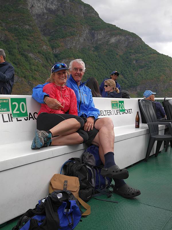
Now, for one reason or another (mostly training for three West Highland Way Races in 2007, 10 and 11 as well as my Winter ML assessment in 2011), that timescale for Kenya slipped a bit, but it remained firmly on the agenda (no way did I want to be looking back in old age saying ‘we should have done that’!) and we finally booked a package with EWP (run by a friend of a friend) for Christmas 2011 to take us from Nairobi to the mountain and provide us with porter/cook support while leaving us free to do our own climbing. And then, after much careful planning and rationalisation of gear (helped by convivial discussions with Mike Pescod and Chris Vind, who’ve both been there several times), we were actually on our way.

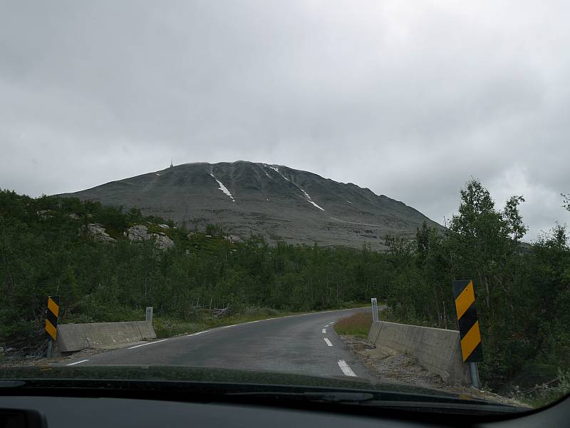
Arriving at Nairobi on Christmas Eve, we were met by Kingston and Dickson (‘Mike Pescod is my friend so you are my friend’!) before driving on roads good, bad and unfinished (all typically shared with overladen pushbike, motorbike and donkey cart) to Chogoria in the ubiquitous Toyota Hiace (surely Kenya’s most common vehicle!) to pick up Alfred (our cook and de facto guide), Douglas, Festus, Ken, Kenneth, Jack and Jackson, who’d all be working as our porters. And then we set off for the Chogoria Bandas (huts) with eleven of us (a new driver taking Dickson’s place) bouncing up a severely eroded, rutted and apparently interminable track in an old Landrover before Angus and I finally got dropped off with two of the crew to enjoy a walk up the last bit! Have to say I was surprised by dinner, with one crucial piece of information (‘SPECIAL NOTES – NO SEAFOOD OR FISH FOR PETER’) apparently not getting through from EWP, but a pretty comfortable night (buffalo banging against the huts!) at nearly 3,000m was followed by our first distant sighting of the twin peaks of Batian (5,199m) and Nelion (5,188m), with a bonus elephant to boot.

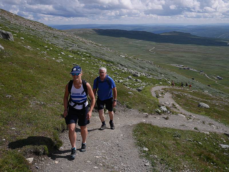
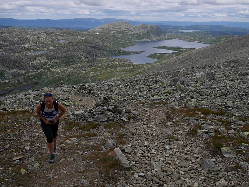
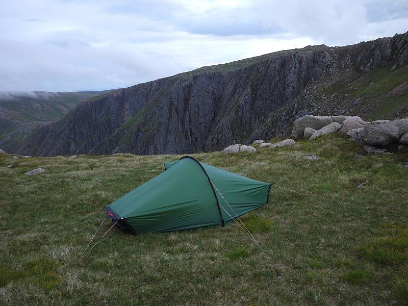
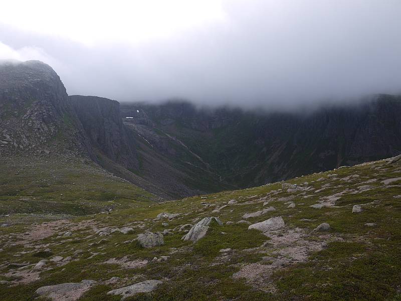
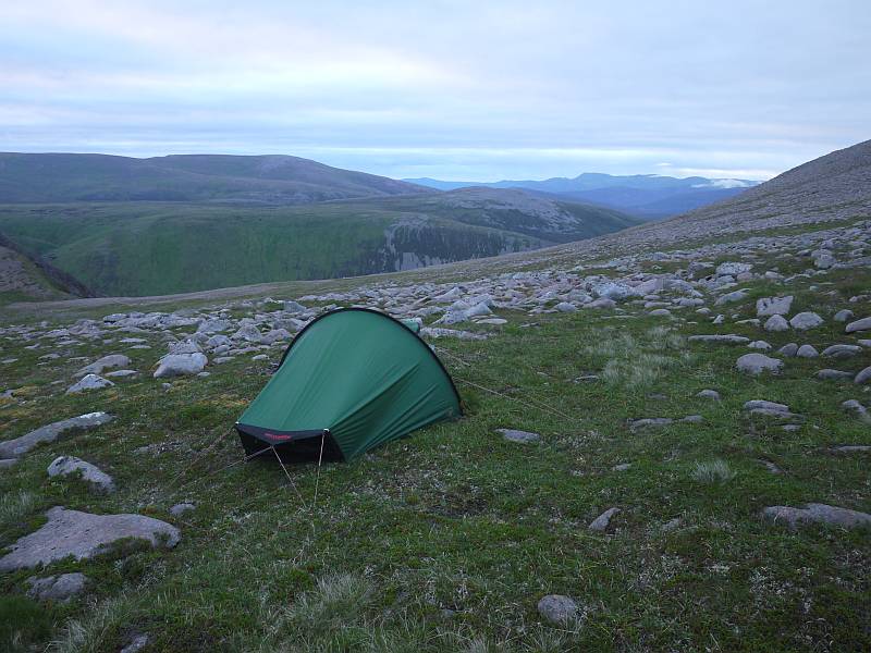
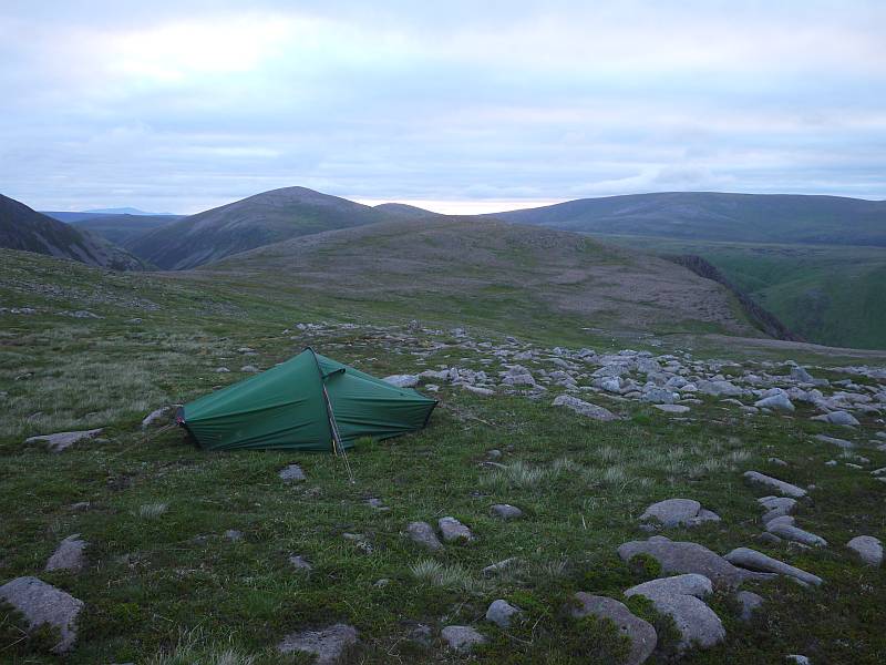
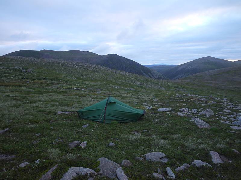
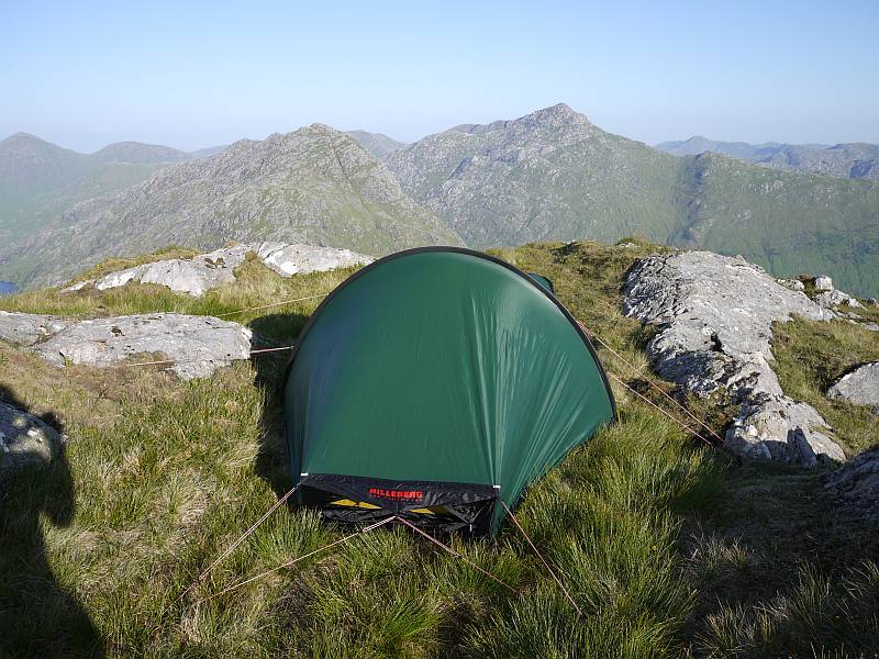
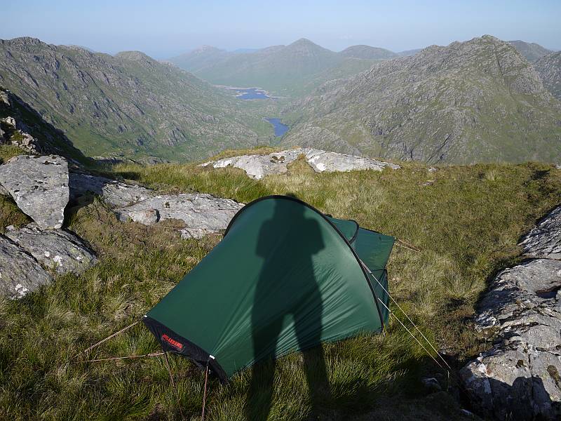
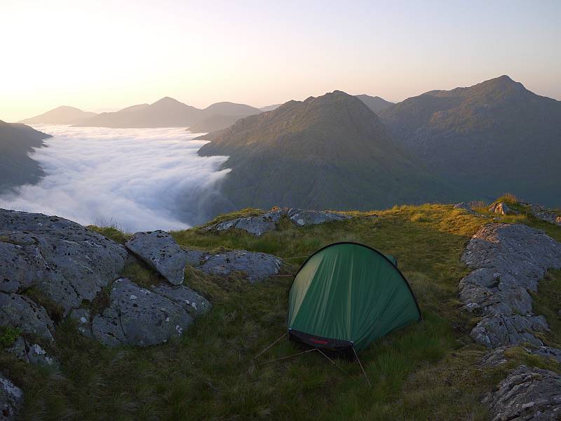
Now, Mount Kenya’s notorious for its significant incidence of AMS or Acute Mountain Sickness, with excessive haste fuelled by underestimation (when it’s neither particularly high nor difficult in global terms) probably the principal cause, so our walk-in was carefully planned to give us the best chance by proceeding ‘pole-pole’ (essential Swahili for visitors!) up and down over five days, with camps at Nithi (3,300m), Lake Michaelson (c.3,950m), Simba Tarn (c.4,600m) and the Austrian Hut (4,790m). But I was plagued even so by blocked noses and headaches resulting from those long, stuffy, twelve-hour nights lying in the tent (the temperature dropping quickly enough to drive us in at dusk most evenings) and we saw ample evidence of misjudgement and/or bad luck on meeting others retreating from tighter schedules with hacking coughs.

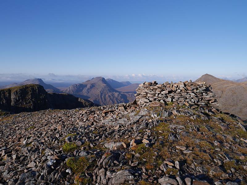
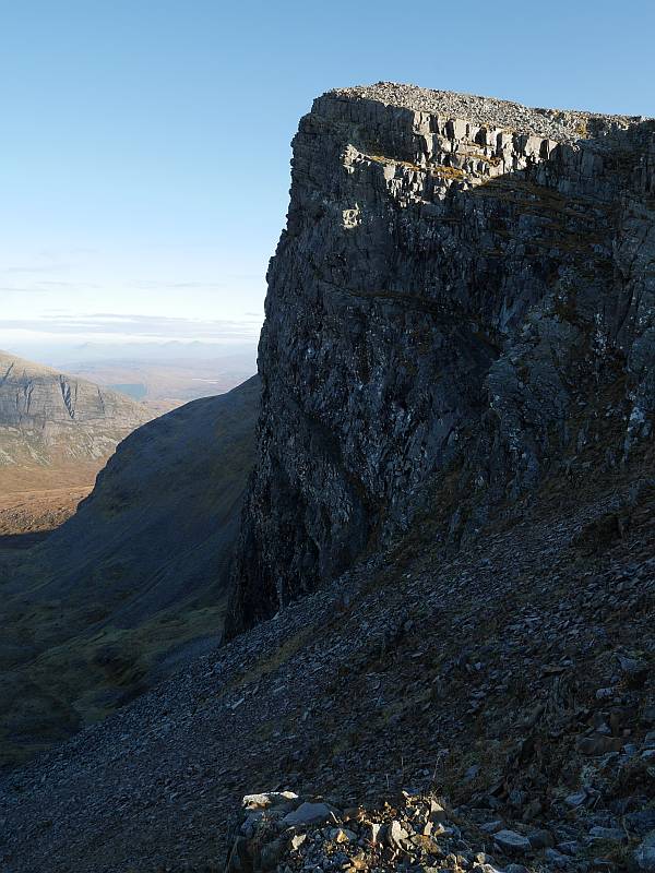
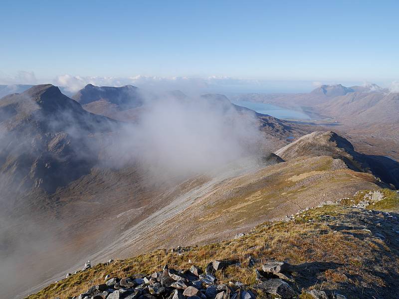
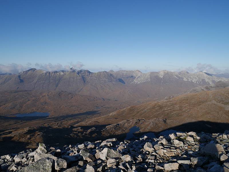
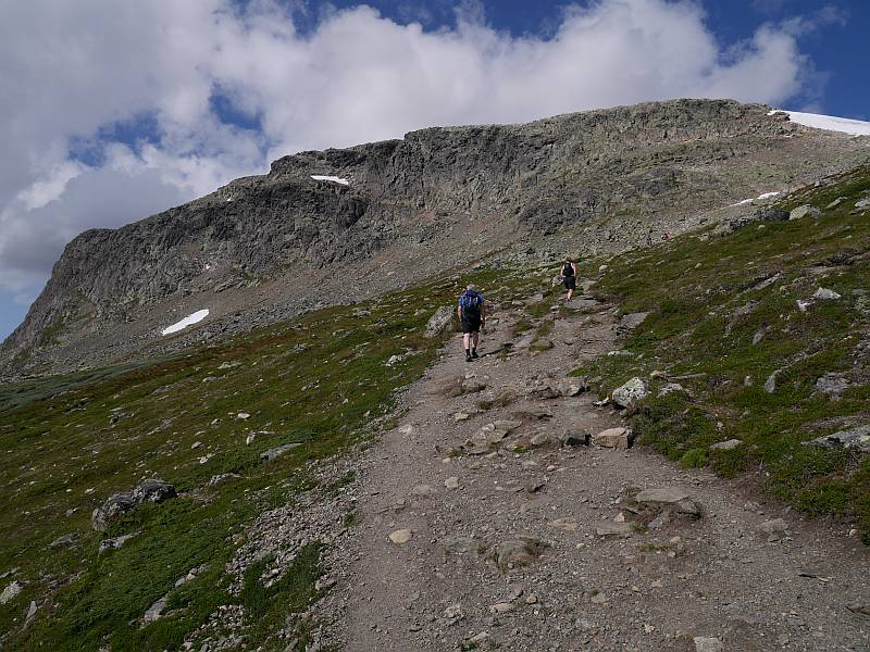
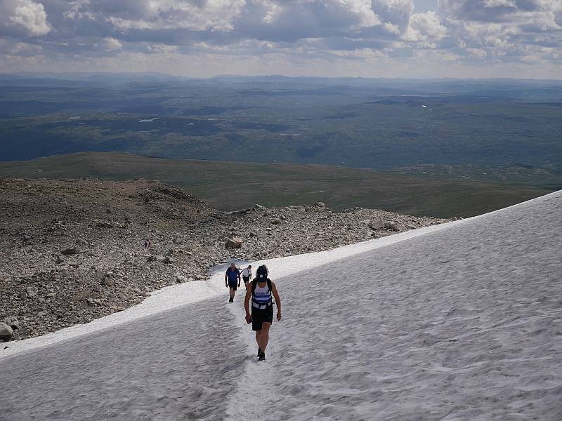
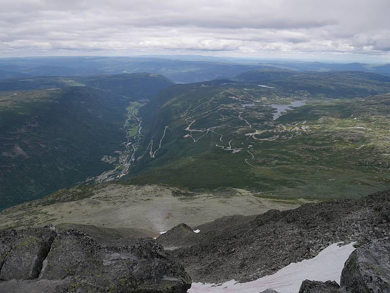
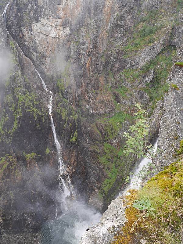
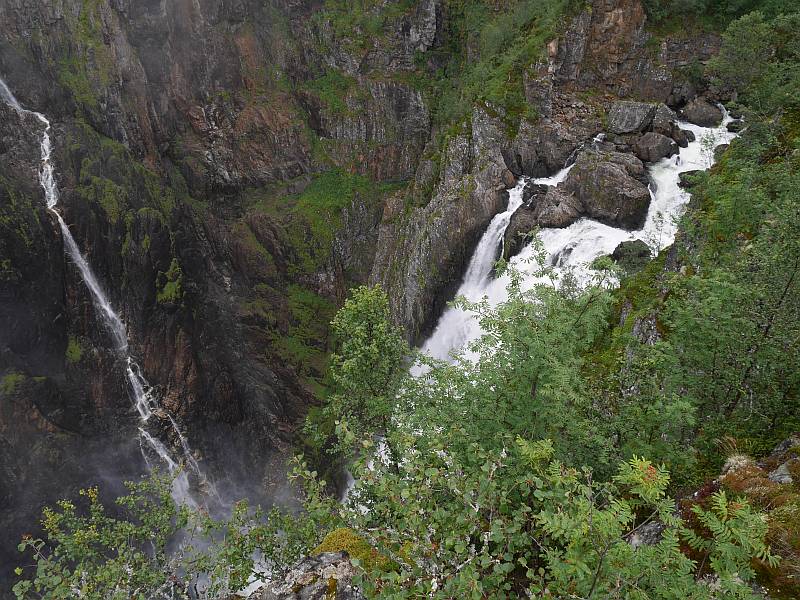
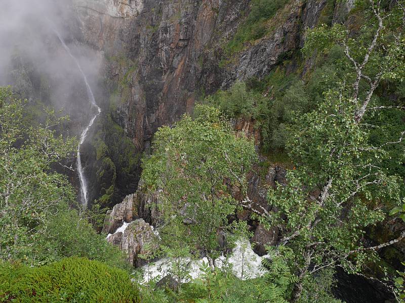
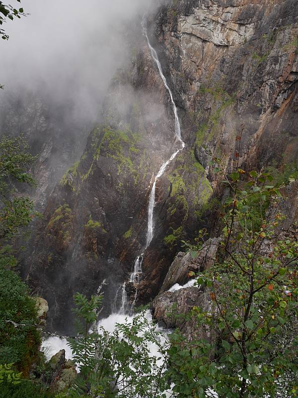
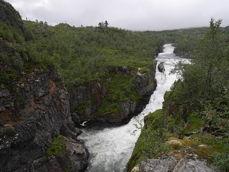
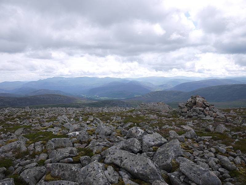
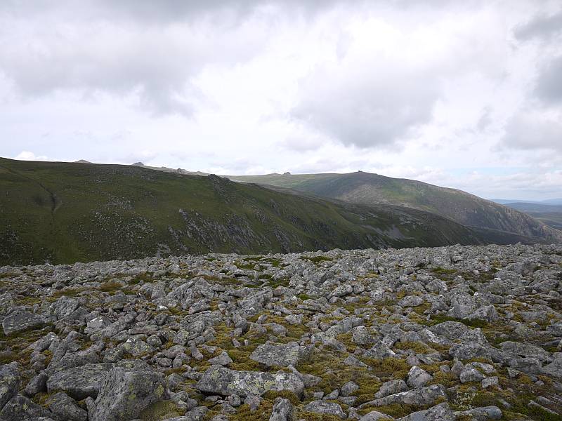
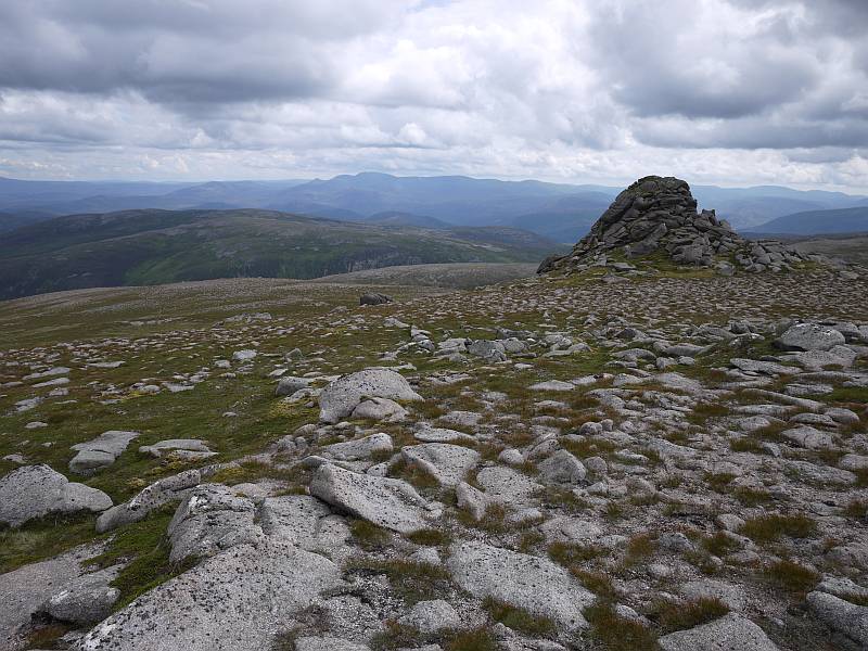
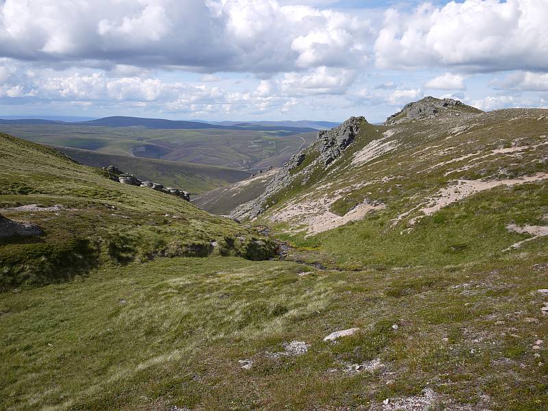
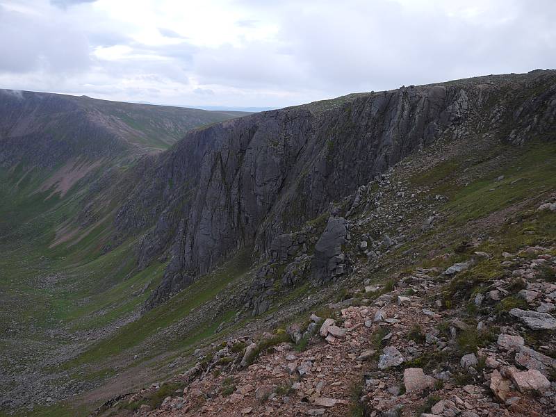
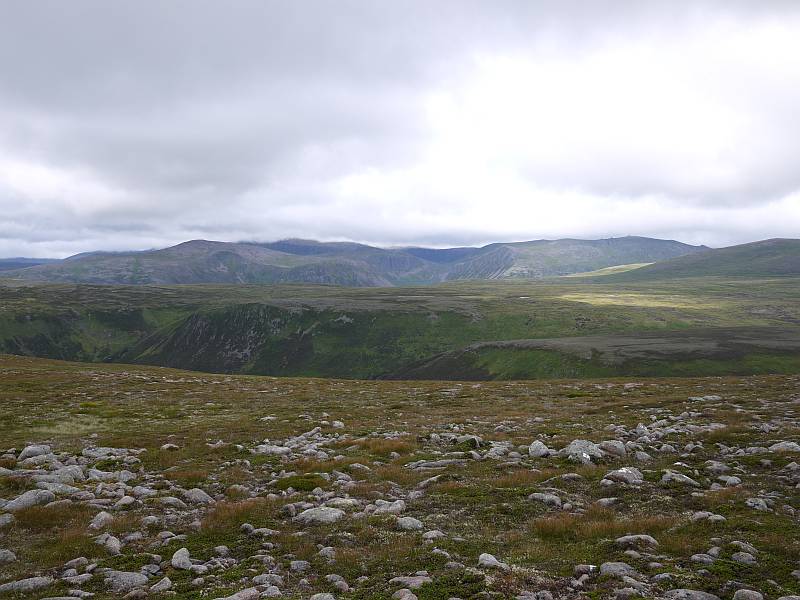
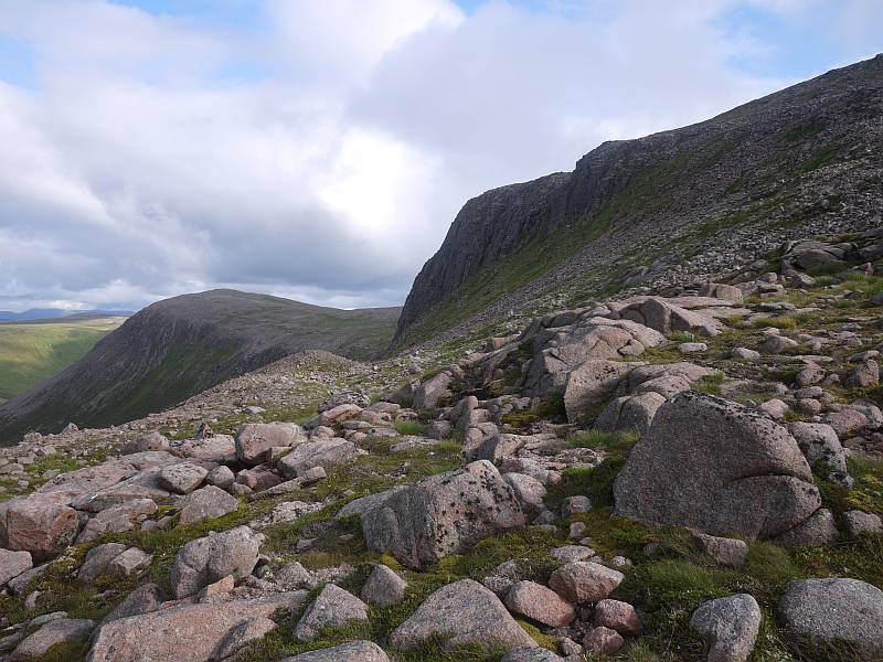
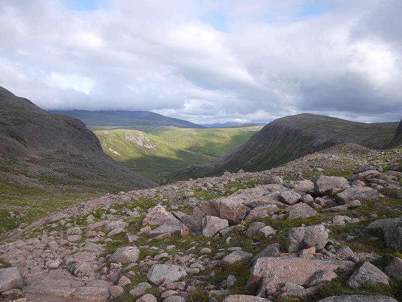
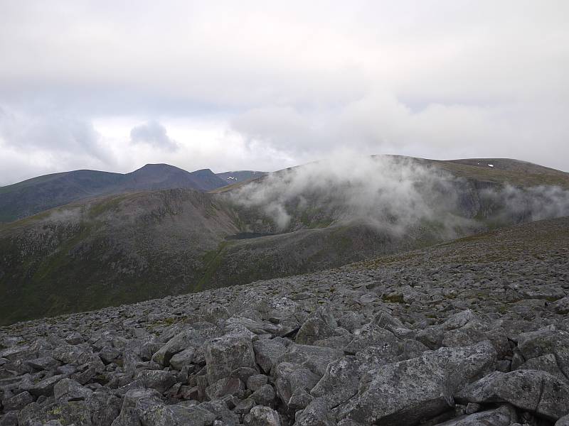
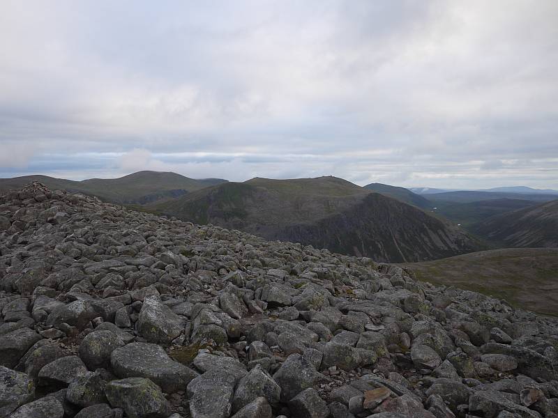
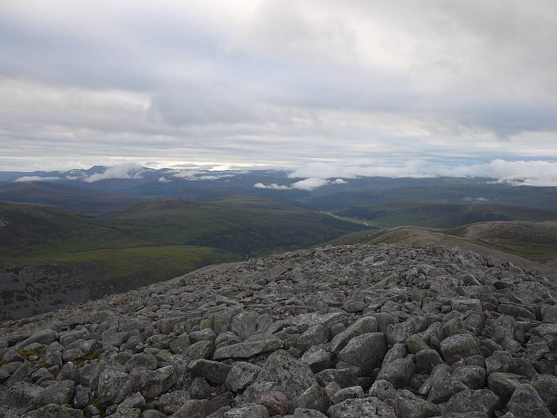
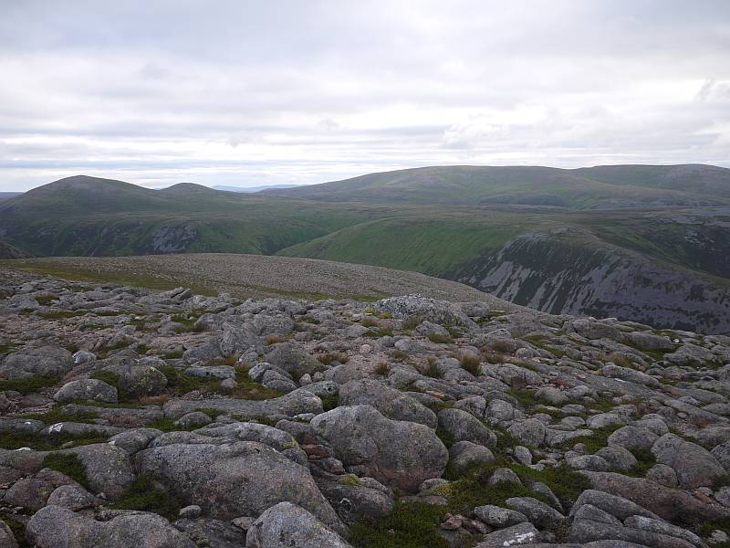
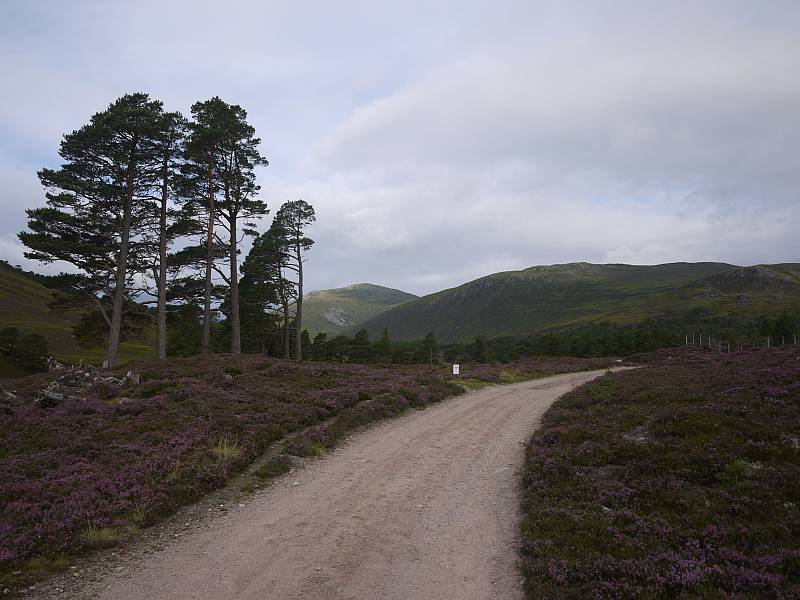
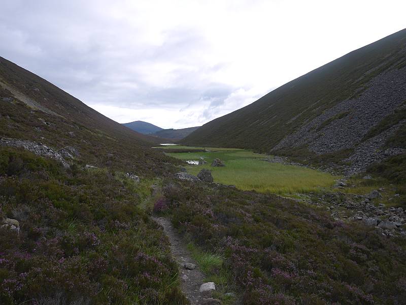
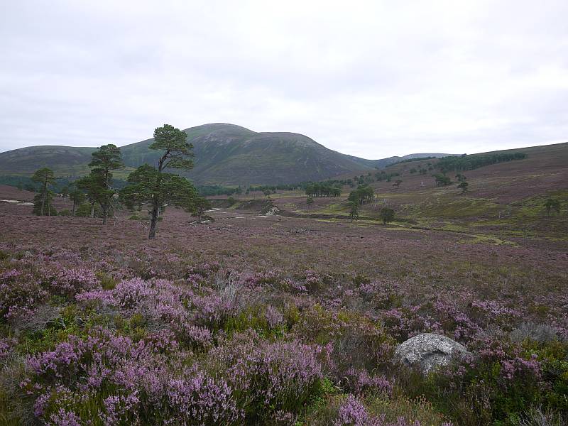
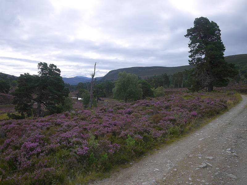
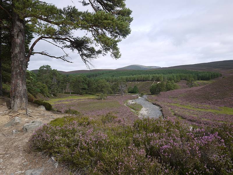
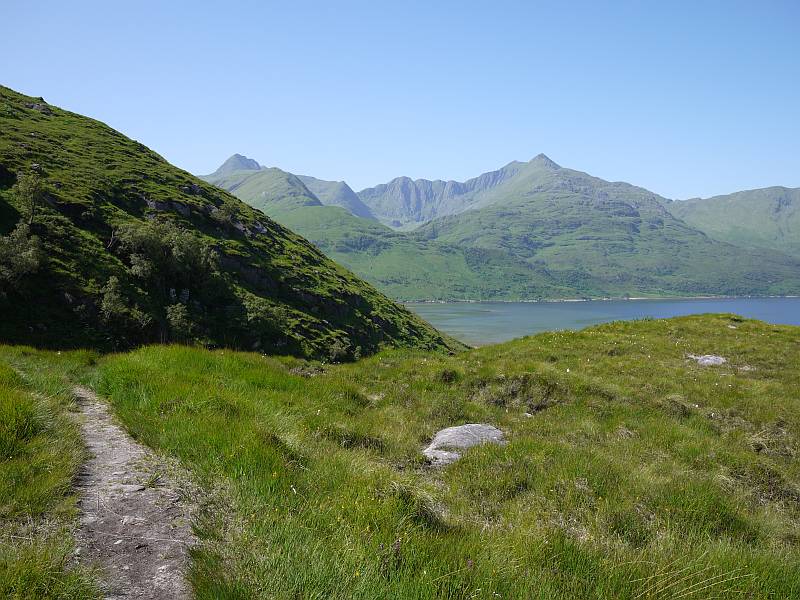
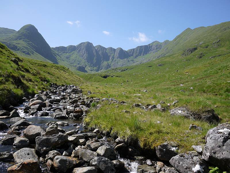
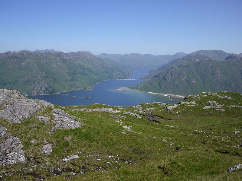
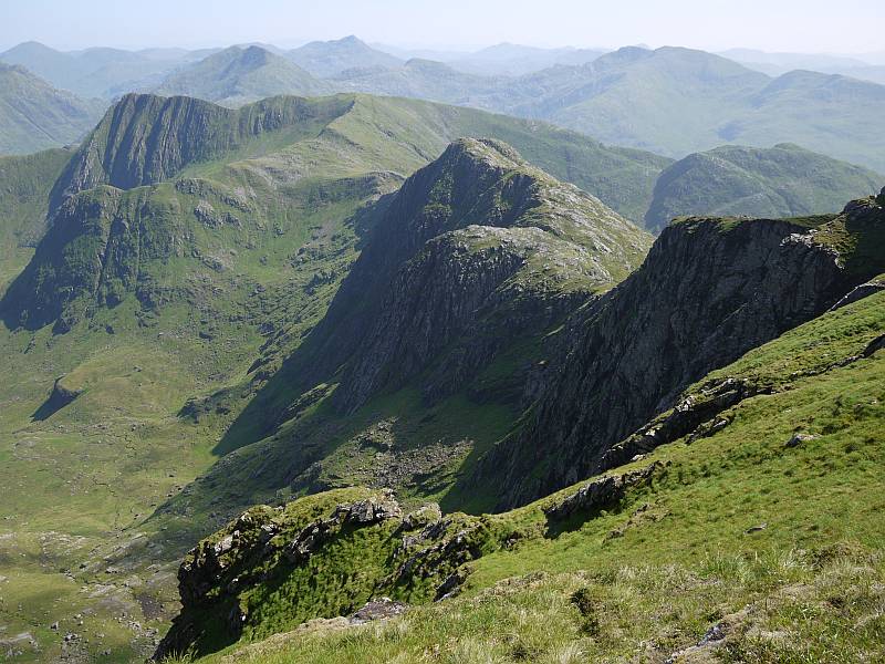
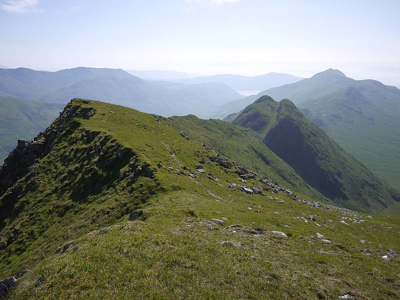
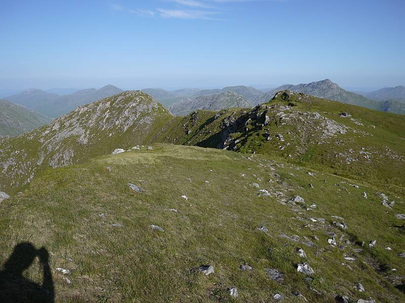
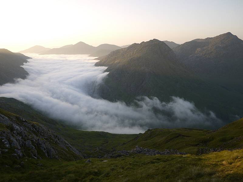
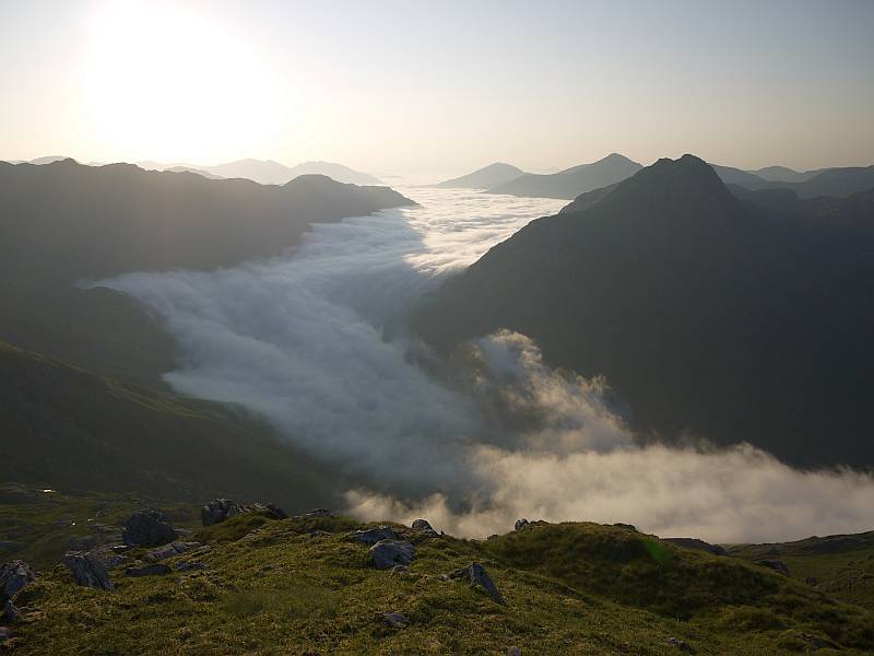
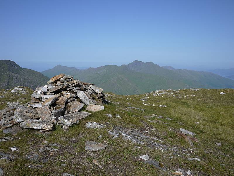
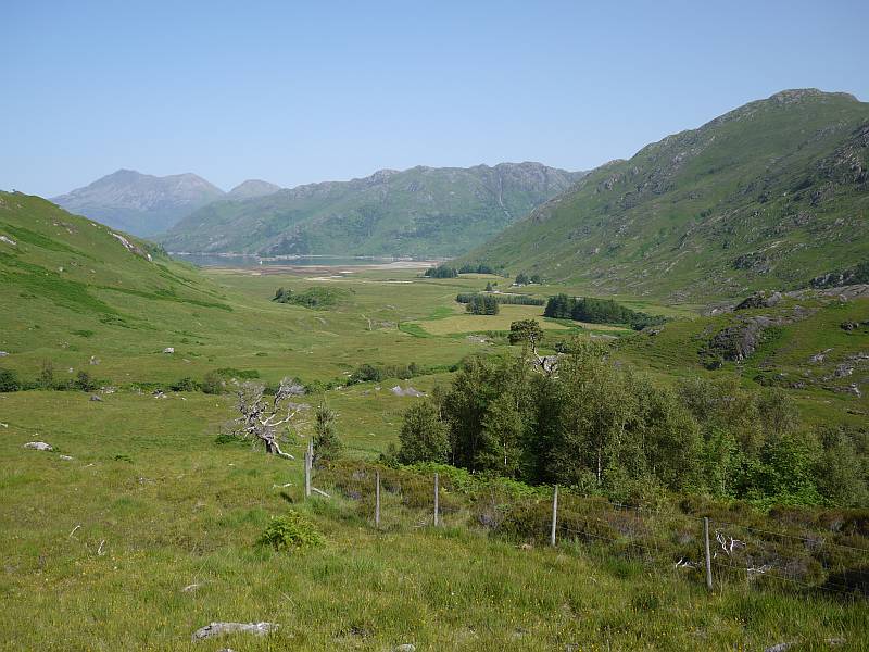
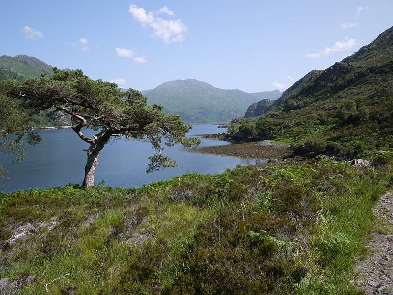
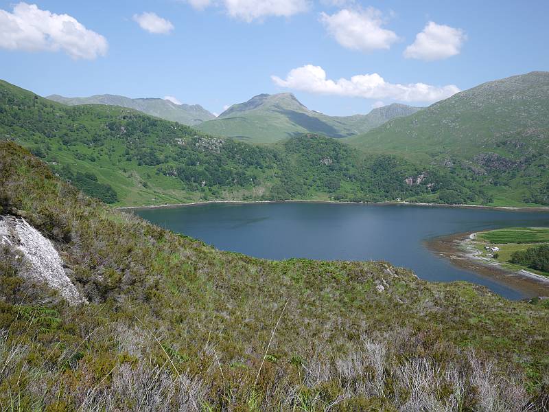
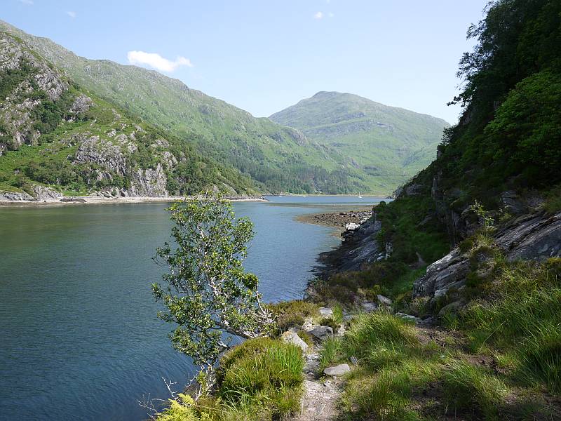
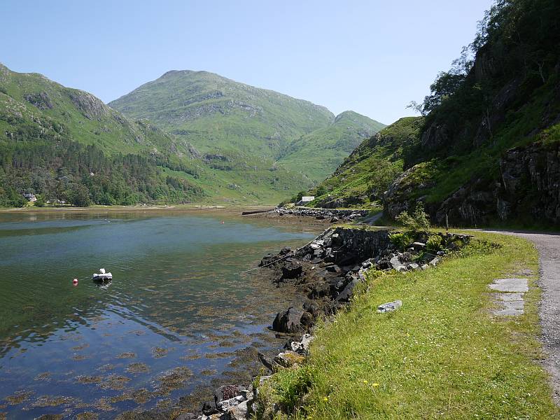
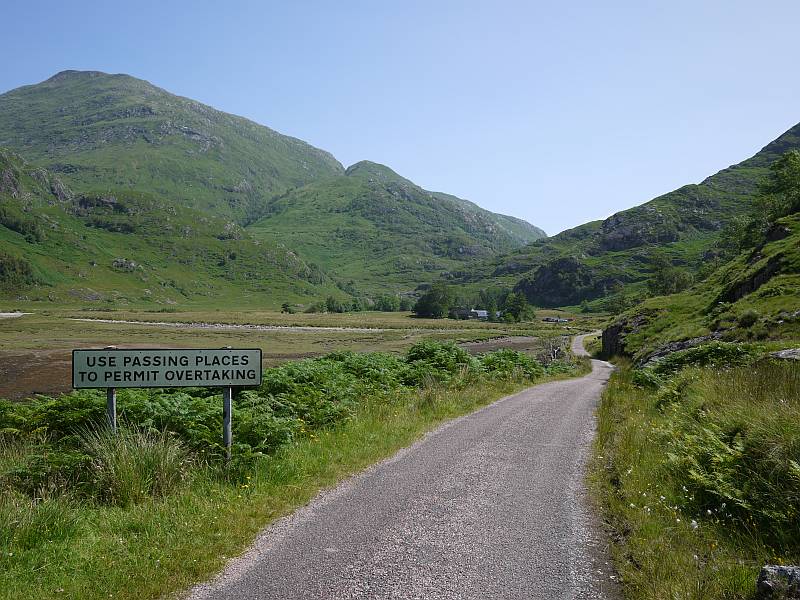
Trying to convey the wonders of that walk-in through a handful of two-dimensional words and photos is quite frankly impossible, but who could forget that Christmas trip to the Nithi caves and waterfall, the spectacular setting of Lake Michaelson nestling in the floor of its stupendous gorge (try to imagine yourself looking back from high up the ‘gorges’ photo in real-life 3D!), or scenery and vegetation that swung between the surprisingly familiar (look down here and you could be in Scotland) and the totally new (look over there and you most certainly couldn’t!)? Not to mention both ‘Scottish’ weather (mist, rain and then snow at Simba Tarn, with few sights of our peaks for the first few days) and ‘Kenyan’ (blue sky and sunshine of course!), with ‘cultural’ discussions where (prompted by questions about what we made of it all and how things compared to home) I maybe took on the impossible in attempting to express my mixed feelings of excitement at being there, guilt at being the ‘rich white man’ abroad (numerous pushy selling/trading/begging episodes at roadside stops having already left me feeling very ‘white’!) and hope that our presence was nevertheless bringing our companions profitable employment.

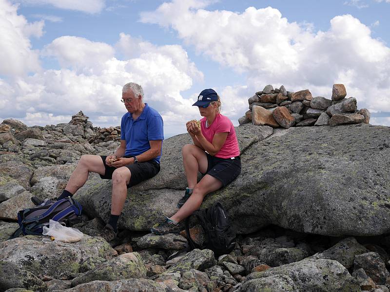
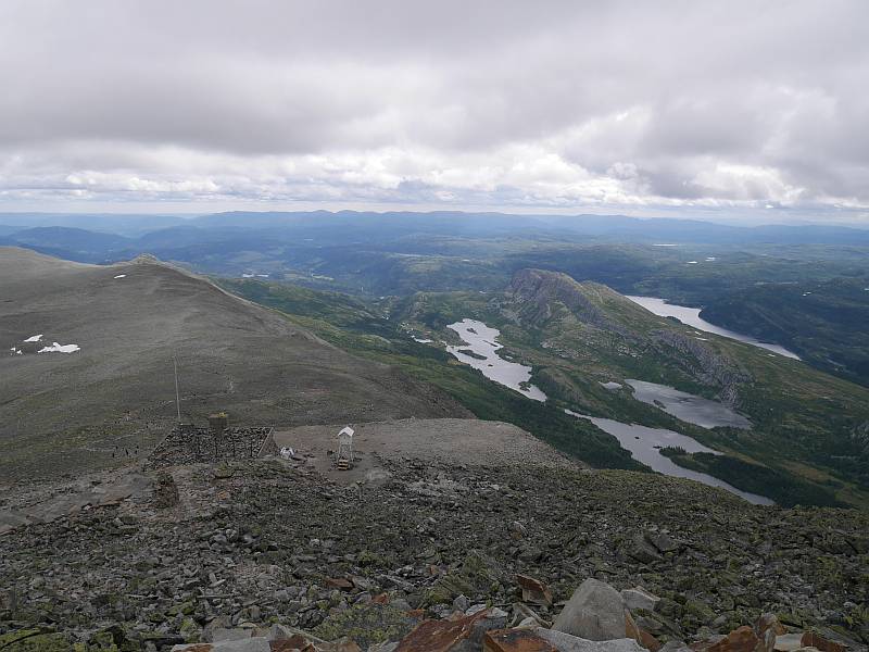
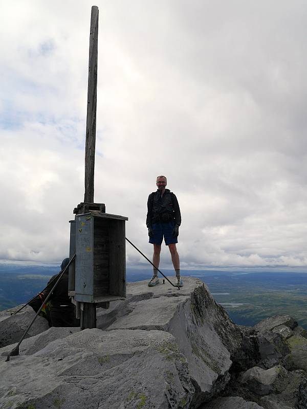
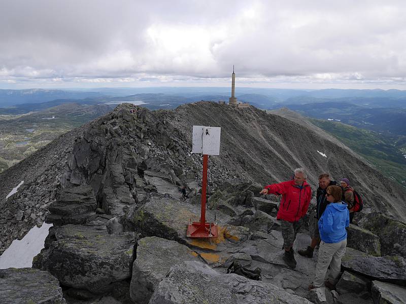
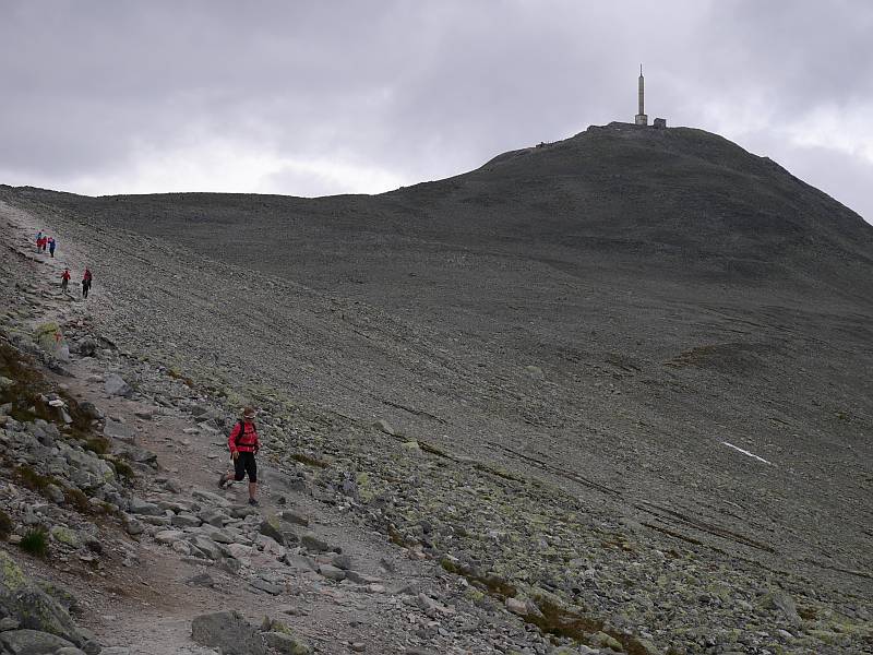
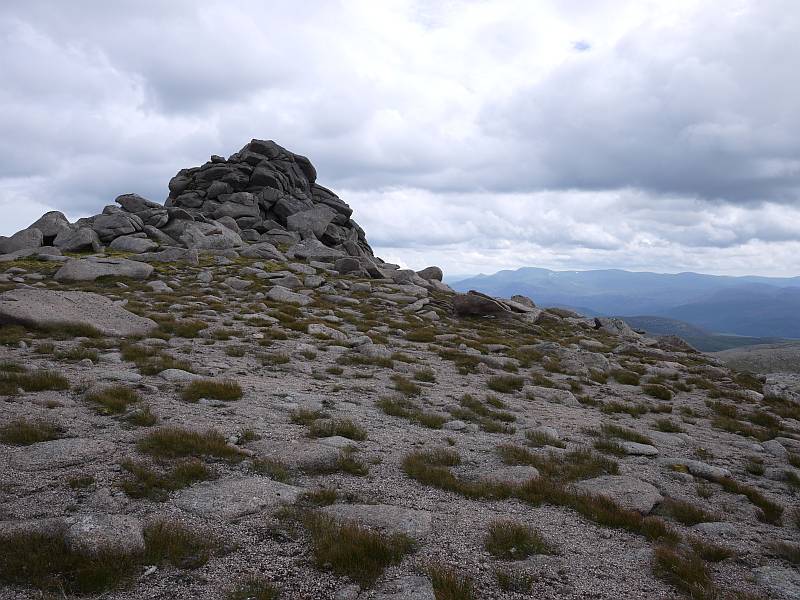
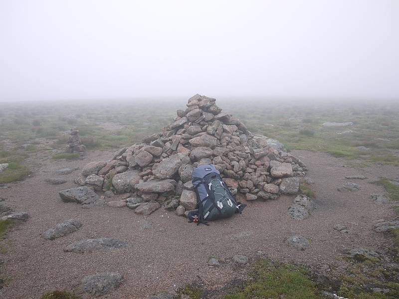
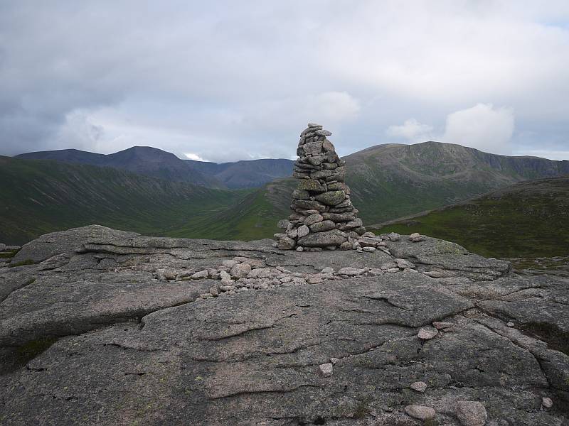
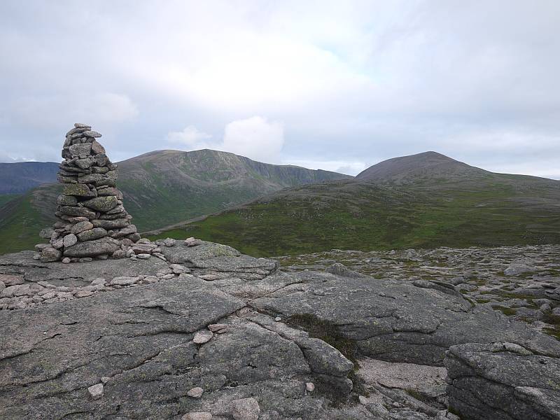
So here we were at the Austrian Hut on this very windy Wednesday, with Point Lenana (Mount Kenya’s third peak at 4,985m, and magnet for excited trekkers) bagged in the morning (no, I never touched the steel cable and five or six steps now fixed to the rocks!), two of our porters on their way home with the load lightening every day, a solitary guide/client pair successfully negotiating the Normal Route on Nelion (which we hoped to complete as Shipton and Tilman did by crossing the Gate of the Mists to Batian) and another party making much slower progress before finally retreating after apparently losing time off-route. While our schedule did allow for a practice climb up Point John (or similar) or further acclimatisation day, we’d pretty well agreed to go straight for the big one if conditions (both health and weather) permitted, and that’s what we did… but with the unplanned twist of our late decision to dump the sleeping bags, stove and cookable food (effectively ruling out a planned bivy by taking just bivy bags and duvet jackets). Leaving camp at 5:00am Thursday (my nose gushing blood as I tried to blow it clear!) to cross the Lewis Glacier and tackle the awkward initial scree slopes by dark, we then had to wait (not that long) for the two guided ropes of three led by Felix and Duncan ahead of us to get started, finally hitting the rock as it caught the rising sun at about 6:30am. So we were right with them for the first two (Grade 1) pitches, and here I was thinking they’d be slower (as threes) up the more technical stuff and we’d be able to follow them the whole way, but of course I was underestimating the guides’ slickness on a route they both knew and we were soon back alone completing the trickier traverse (with awkward, airy move to reach the base of Mackinder’s Chimney) to the rib (Grade III or IV, depending on guide) right of the Rabbit Hole. And here I messed up by straying right of the ‘easy rocks’ at the top, landing myself in a properly scary (‘trouser-filling’) position as I pigheadedly pulled over a steep bulge capped by a loose block before more sensibly instructing Angus to remove my runner (some distance below) and step back left. With this (mainly self-induced) ‘mauvais pas’ vanquished, it was easy climbing (few runners needed) for several pitches up One O’Clock Gully (II) and the slabs (I) to the crossing of the ridge at Baillie’s Bivy, but time was somehow disappearing at an alarming rate and (see the building problems here?) we were neglecting to eat or drink as we pushed to keep moving at the necessary speed…

Having said something earlier about ‘much careful planning’ (possibly already wasted after dumping the bivy gear and bumbling on up!), perhaps I might add that I’d bought all three printed climbing guides and made up a laminated sheet with their Normal Route descriptions and diagrams. But here perhaps too much information proved counterproductive with the mist closing in and the descriptions simply confusing things by disagreeing just when we needed their help most. So we had Cameron Burns telling us to ‘descend about 25 meters onto rock ledges above the Upper Darwin Glacier’ where Iain Allan said ‘turn the Gendarme on the left by first descending 7 to 10 m and then up a large gully’ and the EWP map/guide ‘descend 3m, then up on easy ground (sometimes icy) to the base of a wall.’ Which meant yet more time lost in poor visibility while I tried this way and that, only deducing later that Burns must be describing the original way by Shipton’s and Rickety Cracks (with the ’25 meters’ still only making sense as a descending traverse?) and not De Graaf’s Variation, which is given by the others as the Grade IV crux and may be the ‘easiest, most direct route’, but remains quite a tough cookie at that (think Severe pitch feeling more like VS at over 5,000m). From which you might guess that we did eventually locate it (my assessment of some meaty moves on smallish holds with good rest points and gear being in stark contrast to that of a cold, tired Angus, who had a desperate struggle to follow), but that really was the beginning of the end with ambition, realism, hope, common sense and goodness knows what else all battling in mental (mortal?) conflict and another easy pitch up the ridge above taking us to what we conceded to be our high point of just over 5,100m…

So it was mid-afternoon, we’d done the crux and, with ‘just’ a couple of short Grade III sections (the first an ‘unobvious traverse’) and some Grade I ground between us and the summit of Nelion, I’ve little doubt that we’d have got there (and probably even over to Batian) by nightfall. But we were cold, tired, hungry, thirsty (nay, I was raw from drinking nothing while puffing away at altitude!) and, with no sleeping bags or stove, needing to get down. While it was still sorely tempting to press on, we’d be committing to (at best) the bivy from hell followed by a tricky descent in even (probably much!) colder, tireder, hungrier, thirstier shape and (at worst)… well, who knows? We’d just spotted the two (successful) guided ropes abseiling back towards us, were aware that a couple of the bolted abseil points might be tricky to find, could see the logic in following a group who knew them all, and that was that. It was a no-brainer (simultaneous, ‘telepathic’ agreement) and we were going down!

Now, we might have been slower than the guided parties climbing up, but they had six to get down (one of them injured after somehow swinging into the rock) where we were just two, and much waiting (as well as considering how we could help) ensued before we thankfully accepted Duncan’s invitation to share ropes and speed things up for all eight of us. So Felix took our ropes and theirs to fix multiple abseils for everyone, with Duncan and us bringing up the rear to strip the abs as we followed the others down (strangely our second ‘joint’ big mountain descent after previously sharing ropes with an RMI party on Mount Rainier). The sun was back out (quite a tease despite our very sound decision!) but the abs were purgatory (it’s a long way down but we must have gained all that height on the climb!), with some being overhanging and even conspicuously free (Duncan admitting to hating that one) and me now tired enough to be needing mid-rope rests (you might not equate sliding down a rope with effort, but everything’s so bloody tiring at altitude!). With it getting dark as we came off the face, we still faced a ghastly descent down that blocky scree to the Lewis Glacier, one of the weariest trudges of my life back up to our camp at the hut and a night so cold that I still shiver at the thought of the bivy we’d escaped, but we’d given it everything and, despite some natural disappointment when the day had started so full of hope and expectation, been respectably (truly!) high on the mountain. For sure we’d made mistakes (probably starting with ditching the bivy gear in the hope of climbing quicker) and been too slow (for which we could blame everything from misty route-finding dilemmas and confusingly contradictory guides through time-consuming over-engineering of belays to simple inexperience of covering that kind of ground at altitude with the speed required for success), but lessons were learned, I’d get to the same place in half the time now and it doesn’t have to (isn’t going to!) be the once-in-a-lifetime shot I’d first imagined.

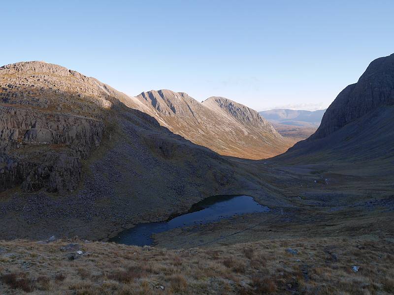
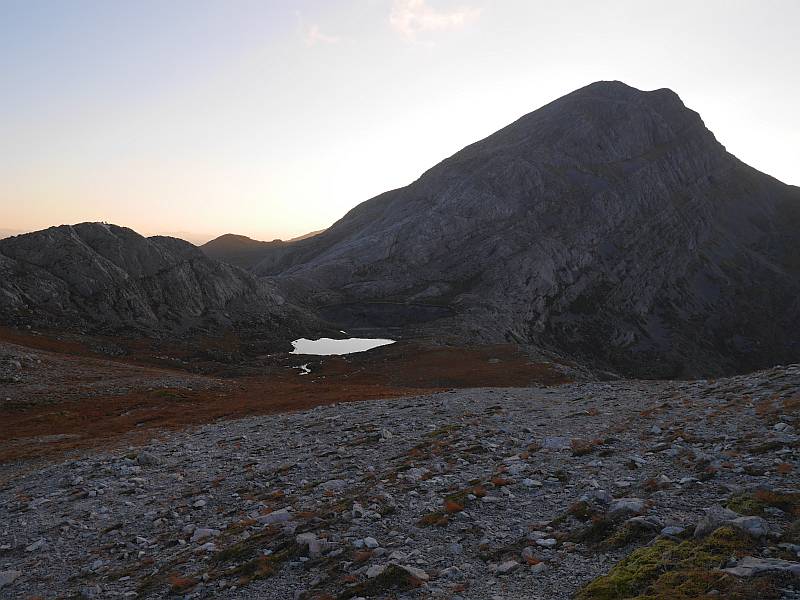
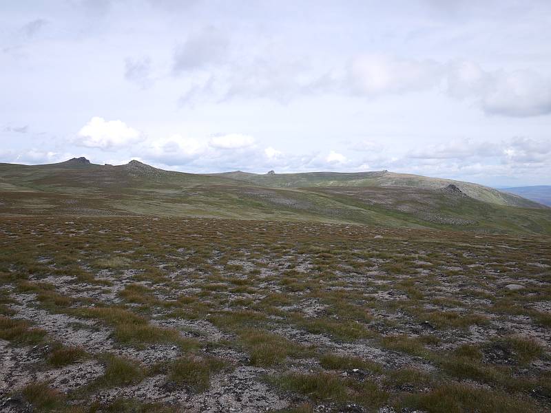
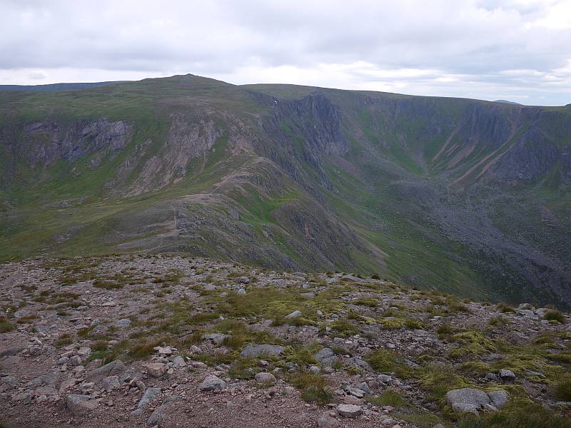
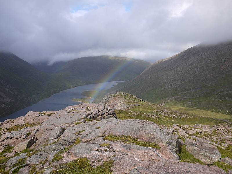
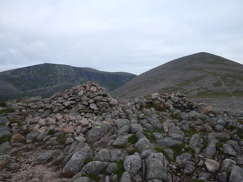
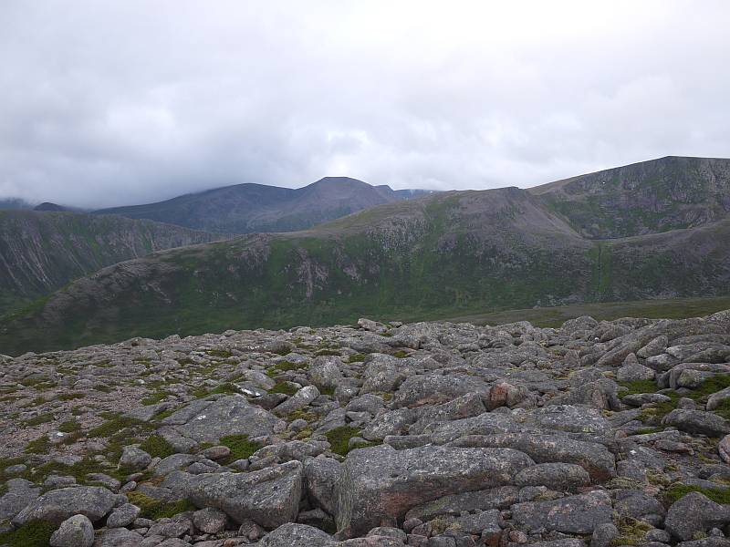
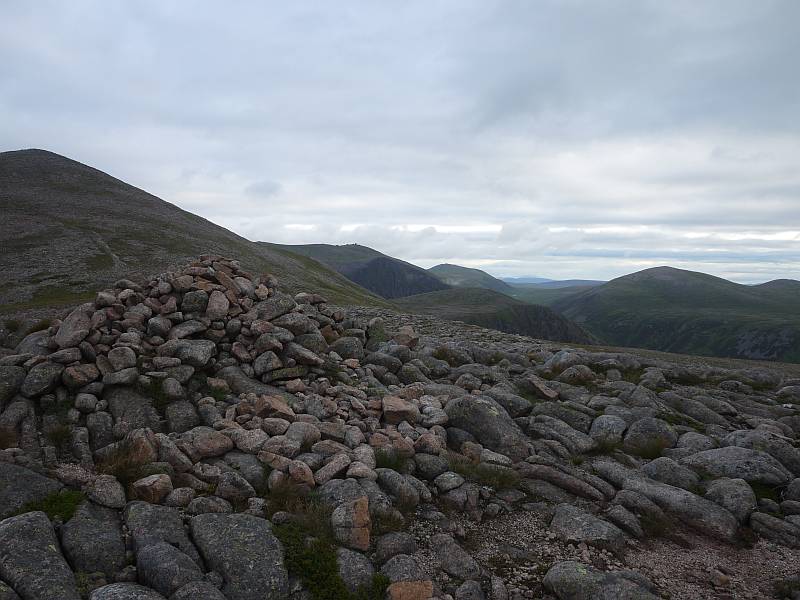
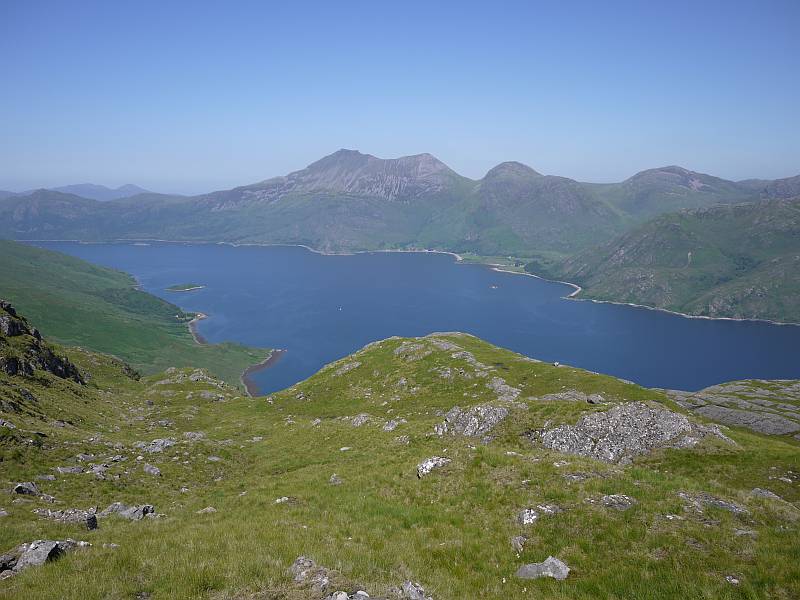
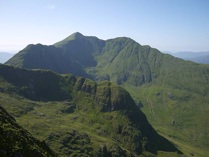
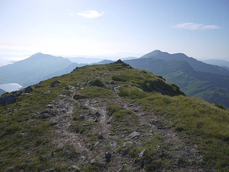
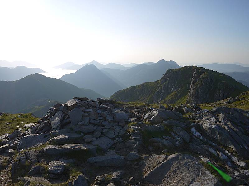
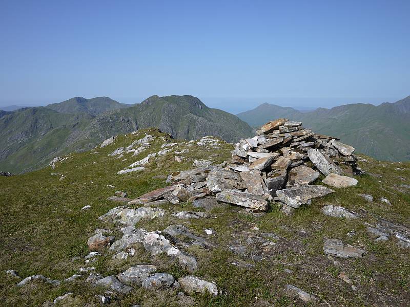
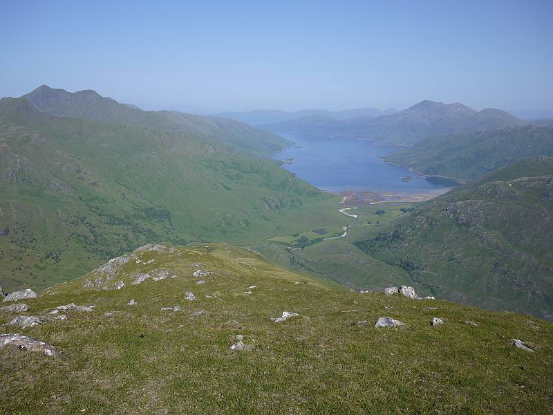
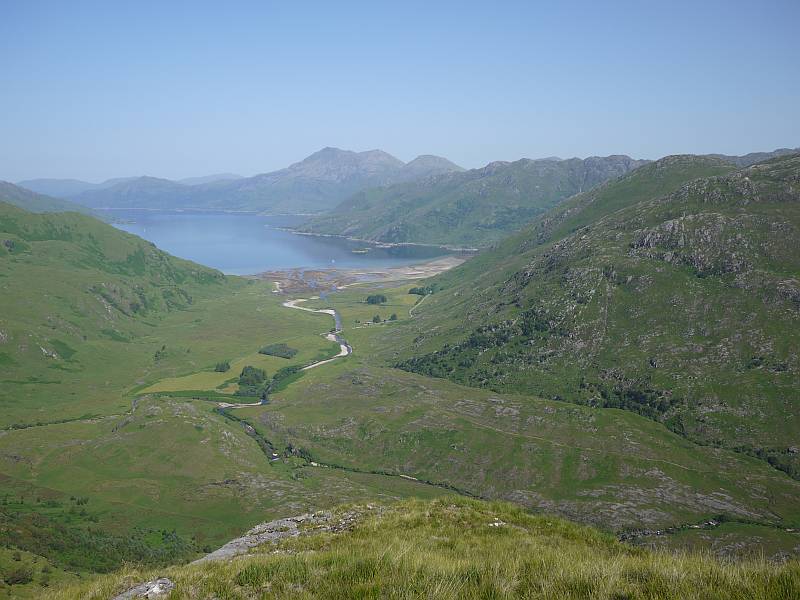
As for our next moves when we could maybe have given it another go, we’d tried to make a ‘flexible’ arrangement (pending outcome of the climb) for a few days’ safari but, with no easy way of rearranging that from the mountain, felt effectively committed by our booking and might even admit to craving the change as the mounting days at altitude took their toll. So, despite mixed emotions on abandoning our coveted peaks to others (with both Nelion and Batian climbed during the clear days of our descent), we’d had enough, needed to get down for some air and were happy just to complete the circular tour by way of easy days to Mackinder’s and Shipton’s Camps at c.4,200m before leaving via the Sirimon Route. And here at least (or last?) we were rewarded with the most spectacular views, with the descent to Mackinder’s disclosing a staggering series of new angles on those now familiar peaks and spires before settling down to the ‘classic’ view of Batian and Nelion split by the Diamond Couloir and Glacier, Shipton’s (where I set my personal altitude record for appalling piccolo playing!) notable for both the attractive prospect of Terere and Sendeyo (something of a cross between Stac Pollaidh and Suilven?) and sterner north side of Batian, and the Sirimon walk-out on New Year’s Day the stunning vision (eagerly anticipated from Chris Vind’s slides) of Batian as the great icy fang you might imagine from Felice Benuzzi’s description. So I’ve uploaded a fair sequence of photos to show some of these striking scenes, but had better also explain the ‘seaweed’ one as being named for the lichenous rock so prevalent on the climb over the Hausberg Col to Shipton’s Camp and conjuring up the strange vision of some cosmic low tide on a 4,500m seashore!

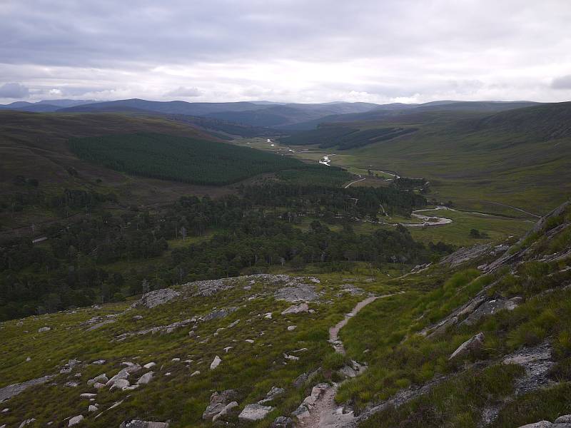
And so to the safari I’d formerly only been able to see following a successful ascent, with a further night’s camp at Old Moses (3,300m) taking us to the Sirimon Gate and another rendezvous with Dickson and his Hiace leading (via a night at Naru Moru River Lodge, where we found attractive grounds but no hot water!) to many never-ending drives on disintegrating roads in another Hiace (what else?) with Francis and Alfred, who stayed with us as cook for the whole trip. Had we guessed that ‘camping’ safari meant a night (at Lake Nakuru) in what I’d call a holiday cottage followed by two (in the Maasai Mara) in a canvas bungalow with real beds, tables and chairs, plumbed loo, basin and shower when we’d expected a simple tent like the well-used Gelert we’d just spent eight nights in, perhaps we’d have skipped the Lodge, but you live and learn! To sum up our safari sightings, we scored a clean sweep of the ‘big five’ (buffalo, rhino, lion, elephant and that elusive leopard up a tree), with huge supporting cast of (in no particular order) baboons, monkeys, hyraxes, zebras, giraffes, hippos, warthogs, hyenas and ostriches, so many types of antelopes (including my naturally favourite impala) and birds (yes, I know the ostrich is a bird!), solitary crocodile, cheetah, jackal and something-or-other-cat that Francis excitedly pronounced very rare, and probably loads more I’m simply forgetting right now. But the grisly highlight has to be the pride of lions stalking the herd of topi, giving chase (we thought the lioness had gone too soon but she knew best!), bringing one down and noisily devouring it… a genuinely exciting sight when it’s ‘live’ (as in happening before your eyes) and the outcome unknown! So the safari was good (with Francis an impressively knowledgeable and enthusiastic guide), I’m glad we did it and happy to have brought the memories home, but must also say I’ll not be rushing to repeat the hundreds of boneshaking, dusty miles involved in getting there and back (so surely a prime national asset like the Maasai Mara deserves better than that hellish ‘road’?) and couldn’t stand many more mosquito bites (something that never troubled us during our ten days on the mountain but proved to be something of a holiday ‘sting in the tail’).

While we’d been eagerly anticipating our final-evening meal at Nairobi’s famous Carnivore restaurant, I’d ultimately have to class this ‘good’ rather than ‘great’, with Kenya’s 2004 ban on the sale of the game meat that used to be its raison d’être being largely to blame and the lack of anything more exotic than crocodile or ostrich (where the Burns guide had specified ‘zebra, crocodile, waterbuck, hartebeest, giraffe, and various gazelles’) being disappointing despite the attractive ambience and excellent cooking of more domestic fare. But perhaps my real gripe here is with Burns’s book when he should have got that right for the 2006 edition and we’d already found it (despite its usefully wider scope) to be consistently outclassed by the Allan guide on the mountain, with the latter’s ‘definitive’ coverage of routes and variations (note the scarily different assessment of the South Face Route!), better geological information (so where’s the nepheline-syenite in Burns?) and fascinating section on place names just some of the reasons we preferred it up there. To which I might add that I’d still suggest getting both (along with the EWP map/guide) for their different content, but cross-checking carefully where we learned the hard way from the ‘De Graaf affair’, and maybe (just maybe!) treating the East African/UK grade comparisons with a pinch of salt where our route surely warrants a good Severe at IV- instead of the V Diff/Mild Severe they give for IV!

So that’s our Kenya trip in a prosaic nutshell, and I’ve been wrestling for days with the words and photos (choosing the ‘right’ ones from 802 proving almost as tortuous as the writing!) to commit even this shadow to type. But so much of interest and importance remains unsaid, with what I’d envisaged as a glorious conclusion to my dream now looking more like just the first ‘act’ and strong connections to the place and people joining the mountain as reasons to return. No doubt that Batian’s still the big draw (still my ‘magic’, no.1, most wanted world peak!) and I must unlock the Gate of the Mists before this affair can ever be considered over, but there’s so much to explore with Mount Kenya no more a single peak than the North Face of Ben Nevis just a wall, and I’ll be hoping to see some familiar faces when I do. So perhaps I’ll be booking Dickson to do some climbing (when he’s happy to share the lead and I could get excited about heading up there with someone who knows the mountain like he does!) or perhaps I’ll be returning with Angus (hmmm, when?) and/or others, but whatever happens I simply must save the last word just now for Alfred, who worked tirelessly for us the whole fortnight as cook (such good food!), guide and friend, and wish the Mugendi family great joy with the baby daughter born on our final day in Kenya.

Asante sana, Alfred, and here’s to the next time! :-)

11 December 2011

Kahtoolas on my Trangos

Filed under: Walking — admin @ 7:38 pm

Took a wee walk up Beinn na Caillich this afternoon in search of some snow to test my Kahtoola crampons with my Trangos and just about found what I was looking for (ie probably didn’t need the crampons at all today, but was able give them a good enough go to be happily packing them for Kenya). Also tried Dean’s insole tweak for my right boot (something else I needed to test ‘for real’), and pleased to report that I was out for four hours without my bunion aching once, so now pretty confident that I’ll be able to keep my feet comfortable on the mountain. :-)

31 October 2011

October blog post

Filed under: Cycling,Running,Walking — admin @ 6:42 pm

So it’s nearly two months since my last post, my last chance to add an October 2011 link to the blog archive, and I’m just dashing off a brief report of a pretty momentous weekend involving a trip to Culra bothy for Carn Dearg as Jamie Bankhead’s last Munro…

Now Culra’s really quite a long way from anywhere, so I’ve chopped out a larger area/smaller scale map than usual to show that, with our MTB tracks in blue, Saturday walk in red and my Sunday morning run in green (NB all drawn since I wasn’t carrying a GPS). And we had an ‘interesting’ bike ride into Culra in deteriorating conditions late Friday (arriving c.midnight) followed by a wild Saturday afternoon on Carn Dearg, for which congrats to Jamie of course! Then, having survived the post-compleation [sic] party in good shape after the remaining half bottle of my malt whisky went AWOL (ie not drunk by me), I ran up Sron Coire na h-Iolaire and Beinn Bheoil on Sunday morning to make good my negligence in narrowly bypassing the cairn of the former on a previous Ben Alder/Beinn Bheoil circuit without realising it was a counting ‘Top’ (the things you sometimes have to do to claim a hill you’ve to all intents and purposes already climbed!). But at least I got rather better (‘improving’) conditions for this despite nearly getting blown off my feet descending north off Beinn Bheoil, and we enjoyed an altogether more pleasant cycle out (with some carrying where the track disappeared into Loch Pattack) in the afternoon before the weather turned again (deteriorating later and as horrible as Saturday today).

19 February 2011

WML Assessment

Filed under: Climbing,Walking — admin @ 10:35 am

To get straight to the point, I’m back from Glenmore Lodge (as I posted on Facebook last night) ‘relieved beyond measure to be home with a WML pass when I thought I’d maybe blown it!’

It was a gruelling five days… physically OK for a fit guy (although Thursday’s post-holing round of Loch Avon, ‘all the zeros’ et al. was tough with just a litre flask of melted snow to drink), but mentally one of the most tortuous and demanding weeks I can remember. No photos because I took no camera when even thoughts of using it would likely have impaired my concentration, but you’d be looking at some stunning scenery from that one stunning day if I had. No Northern Lights seen from our snow-hole site NE of 1082 (above Stac an Fharaidh) either because the brilliant moonlight quickly turned to total clag after we got back there, but at least that let us turn in ready for an early final-day start without feeling we were missing the show. Have to say I made enough mistakes to keep me worrying (doesn’t everyone?), but know I also got some things spot on (my best moment being declining to take my group up a suspect slope to ‘all the zeros’ that the other group had descended maybe half an hour earlier and my assessor agreeing with me!), so believe the happy final outcome reported here to have been in the balance up till the ‘bitter’ (nay, sweet!) end. But that doesn’t matter now, even if I’m feeling something of an impostor staring at a pass certificate stating that ‘the candidate fulfilled the requirements of the syllabus and demonstrated the technical and leadership competence to lead and supervise groups hill walking the mountain areas of the UK in winter conditions.’

Must just sign off by thanking various Lochaber people (notably Mike Pescod, Kenny Grant and Jamie Bankhead) for help along the way and say how nice it is to keep meeting my previous Glenmore Lodge instructors (some of whom I’ve not worked with for years) and finding them not only remembering me (though some might say I’m hard to forget!) but interested to know how I’m doing and wishing me well. It’s a very special place and I’ve made many friends there! :-)

is relieved beyond measure to be home with a WML pass when he thought he’d maybe blown it! :-)

6 February 2011

Final WML preparations?

Filed under: Climbing,Walking — admin @ 9:58 pm

Yesterday I was out with Kenny Grant on breezy, icy Cairngorm ground to go through as much of the WML syllabus as we could. So we headed up by Coire an t-Sneachda and the slope left (north-east) of the Mess of Pottage before continuing over 1176 towards Cairn Lochan to make a tricky descent into Coire an Lochain, dealing with realistic scenarios for rope work, anchors and security on steep ground along the way. And what a contrast to my ‘soft-snow’ training week on much of the same ground, with the unforgiving scoured slopes and vicious wind contributing no end to the technicality of an otherwise bright and pleasant day, and Kenny no doubt glad of his brand new crampons as well as greater experience where I was struggling to flat foot in places with my not exactly blunt older pair! A most worthwhile day, with hiring your very own personal instructor absolutely the way to go when you want to cover your very own personal agenda, and Kenny striking just the right balance between making me think for myself, offering useful feedback and dropping in some great little tips (including a nifty variation of the stomper he got from Alan Kimber). So it might still have been tricky to identify a safe site to practise self-arrest in the conditions, but we managed to find a slope with just about enough length in less than rock-hard snow before Coire an Lochain levelled into self-braking terrain, only for me to promptly start decorating it with a red polka dot pattern by taking a Glasgow kiss from the icy surface when boldly attempting to drop into a slide from an almost standing position (NB don’t try that on assessment)! However, all’s well that ends well and some minutes later (with nose bleed staunched) we were able to continue with a pretty thorough look at my own arresting in conjunction with teaching points for ‘skills’ days.

Spent much of today on my WML home paper before heading out for a late-afternoon run up the Lairig Mor. Which leaves just next weekend for any last-minute practice but, with a ticket for Saturday night at the Fort William Mountain Festival and a planned arrival at Glenmore Lodge on Sunday, I’d be looking at a short day (or days) if I do go out. So maybe time to recognise that I’ve done what I can, am as ready as I’m going to be and (short of looking up books and slowing up a couple of evening trail runs to try yet more pacing) heading up for better or for worse as I am now! :-)

« Newer PostsOlder Posts »

Blog powered by WordPress. Feedback to webmaster@petestack.com.